Canada's 100th birthday party can be considered to have been Expo 67, held in Montreal. Does anyone remember seeing this logo everywhere?
https://en.wikipedia.org/wiki/Expo_67#/media/File:Expo_67_logo.svg
Canada had only just adopted the maple leaf flag, which now stands for democracy across the world.
https://en.wikipedia.org/wiki/Flag_of_Canada#/media/File:Flag_of_Canada.svg
Our original destination in Canada was Saskatoon. In the summer of 1965, we went there by train after our ship had landed in Montreal. I was not quite five years old, and could not remember anything about Saskatoon, but thought I might remember it if I could see it. We had stayed in a motel, while my father went looking for a job.
When Google Street View became available, I looked around until I found it. The motel was definitely what is now called the Northgate Motor Inn. I remember the name of the main road that the motel was on, Idylwyld Drive, also known as Louis Riel Trail. As we were leaving Saskatoon, having decided to live back further east, the taxi driver that was taking us to the train station said that there had until recently been a train station nearby. Sure enough, there was a restaurant, named Tomas the Cook, that occupied a former train station near downtown.
The following scenes begin at the motel that was our first stop in Canada. We stayed on the upper floor of the motel just to the left, three or four rooms from the end. There used to be a stairway to the upper level of the motel, which I see has now been removed. The doors to the rooms from the outside, on the upper level, have been replaced by windows. Next door to the motel is the restaurant, now Mr. Rizo's, where we would have meals.
There are multiple scenes following. To see the scenes, after the first one, you must first click the up arrow, ^, before you can move on to the next scene by clicking the right or forward arrow, >. After clicking the up arrow, you can then hide the previews of successive scenes, if you wish.
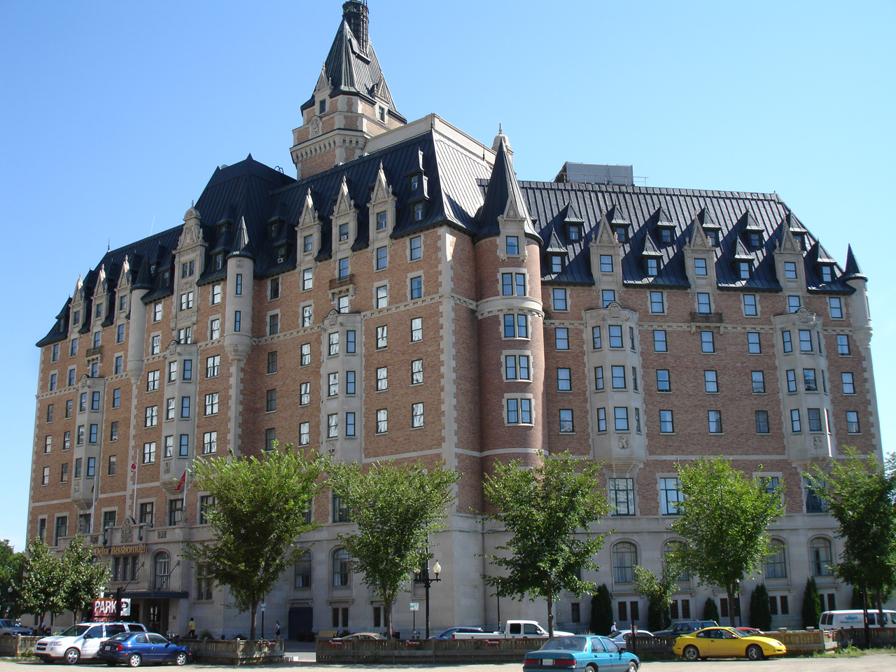
One day, I remember hearing of a magnificent hotel, although I never saw it. It must have been the Bessborough, Saskatoon's version of the Chateau Frontenac and another of Canada's "railway hotels", which includes the Royal York in Toronto.
https://upload.wikimedia.org/wikipedia/commons/0/02/Bessborough_Hotel.jpg
https://en.wikipedia.org/wiki/Delta_Bessborough#/media/File:Hotel_Bessborough_rear_3.jpg
I also remember hearing that the prime minister who had recently led Canada was from the Saskatoon area. It must have been John Diefenbaker.
https://en.wikipedia.org/wiki/John_Diefenbaker#/media/File:Johndiefenbaker.jpg
As we were leaving Saskatoon, and would end up in Niagara Falls, I definitely remember the new train station, which at that time had only just opened, replacing the one closer to our motel which later became the Tomas the Cook Restaurant.
https://en.wikipedia.org/wiki/Saskatoon_railway_station#/media/File:Saskatoon_railway_station_interior.JPG
As we were leaving Saskatoon, our train halted for a period of time directly adjacent to this grain elevator. It is now known as Ardent Mills, but the sign for Robin Hood Flour is still at the top.
https://www.google.com/maps/uv?hl=en&pb=!1s0x5304f6e8440e00ff:0xc04e8de869d1da4f!2m19!2m2!1i80!2i80!3m1!2i20!16m13!1b1!2m2!1m1!1e1!2m2!1m1!1e3!2m2!1m1!1e5!2m2!1m1!1e4!3m1!7e115!4shttps://picasaweb.google.com/lh/sredir?uname%3D115727983079351631197%26id%3D6395632350765036114%26target%3DPHOTO!5sardent+mills+saskatoon+-+Google+Search&imagekey=!1e3!2s-yBbNv3r7_VY/WMHZvM1YslI/AAAAAAAAEjc/gHGkO-NrljwEiDEP-NzPs2cZ14dQQUtagCLIB&sa=X&sqi=2&ved=0ahUKEwj78YDf6-PUAhXEcD4KHZdbCHMQoioIfjAK
I never went downtown. My father walked from the motel each day to look for a job. But these are some general views of downtown Saskatoon.
https://www.google.com/maps/@52.127907,-106.6623196,3a,75y,100.44h,90t/data=!3m7!1e1!3m5!1sALXoE_G-eTfoQgIpMB-BDA!2e0!6s%2F%2Fgeo2.ggpht.com%2Fcbk%3Fpanoid%3DALXoE_G-eTfoQgIpMB-BDA%26output%3Dthumbnail%26cb_client%3Dmaps_sv.tactile.gps%26thumb%3D2%26w%3D203%26h%3D100%26yaw%3D106.71302%26pitch%3D0%26thumbfov%3D100!7i13312!8i6656
This is a residential area, in the southern part of Saskatoon.
https://www.google.com/maps/@52.1036225,-106.6379616,3a,75y,181h,67t/data=!3m7!1e1!3m5!1sXQkjW0JMlGVTev7o0BP6aA!2e0!6s%2F%2Fgeo0.ggpht.com%2Fcbk%3Fpanoid%3DXQkjW0JMlGVTev7o0BP6aA%26output%3Dthumbnail%26cb_client%3Dmaps_sv.tactile.gps%26thumb%3D2%26w%3D203%26h%3D100%26yaw%3D181.5%26pitch%3D-23%26thumbfov%3D100!7i13312!8i6656
On the way back eastward, the train made a stop in Winnipeg. I remember getting off the train and walking around in the train station.
https://www.google.com/maps/@49.889022,-97.1342962,3a,75y,117.46h,90t/data=!3m8!1e1!3m6!1s-Aj0XGi87w2g%2FWR579Pn3lMI%2FAAAAAAAARnM%2FakNllak60XsfwGodK2btygO8BpwD4oazQCLIB!2e4!3e11!6s%2F%2Flh5.googleusercontent.com%2F-Aj0XGi87w2g%2FWR579Pn3lMI%2FAAAAAAAARnM%2FakNllak60XsfwGodK2btygO8BpwD4oazQCLIB%2Fw203-h100-k-no-pi-0-ya98.89205-ro-0-fo100%2F!7i10240!8i5120
Finally, we arrived at the train station in Niagara Falls, as described in the posting on this blog, "Remembering The Old Neighborhood".
No comments:
Post a Comment