Thursday, March 28, 2024

A Journey Around Portugal

We recently visited Lisbon, the capital city of Portugal. Let's continue with a look around the rest of the country. Queluz, which is in the Lisbon area, has the homes of many of Portugal's former nobility. The following scenes begin in the Palace of Queluz, from the 18th Century. The first three scenes of the Palace of Queluz are from Google Earth.


There are multiple scenes following. To see the scenes, after the first one, you must first click the up arrow ^, before you can move on to the next scene by clicking the right or forward arrow, >,  After clicking the up arrow, you can then hide the previews of successive scenes, if you wish.

https://www.google.com/maps/@38.7502912,-9.2595981,2a,75y,161.33h,90t/data=!3m7!1e1!3m5!1sEIRXxKJ0OilrazQje2Qt3Q!2e0!6s%2F%2Fgeo2.ggpht.com%2Fcbk%3Fpanoid%3DEIRXxKJ0OilrazQje2Qt3Q%26output%3Dthumbnail%26cb_client%3Dmaps_sv.tactile.gps%26thumb%3D2%26w%3D203%26h%3D100%26yaw%3D165.23805%26pitch%3D0%26thumbfov%3D100!7i13312!8i6656

In Evora, part of a royal palace remains as well as medieval walls. Portugal is a very old country and history is to be seen everywhere. Also, it was not in either world war so it was spared the destruction. The first three scenes, from Google Earth, are of the square and cathedral of Evora.


https://www.google.com/maps/@38.5715975,-7.9087042,3a,75y,112.28h,90t/data=!3m7!1e1!3m5!1s4Q0LODX1fIC9DPLakXiOyw!2e0!6s%2F%2Fgeo0.ggpht.com%2Fcbk%3Fpanoid%3D4Q0LODX1fIC9DPLakXiOyw%26output%3Dthumbnail%26cb_client%3Dmaps_sv.tactile.gps%26thumb%3D2%26w%3D203%26h%3D100%26yaw%3D117.65728%26pitch%3D0%26thumbfov%3D100!7i13312!8i6656

I live not far from Fatima Shrine, in Lewiston NY. It is a shrine in memory of an amazing event that took place in Portugal in October 1917, in the middle of the First World War although Portugal wasn't involved in the war. It was during the time of the Portuguese First Republic, after the monarchy had been overthrown, that was quite hostile to religion.

First, three children claimed to see a vision of Mary who told them that more visions would take place in the same location. It concluded with tens of thousands of people witnessing what became known as the "Miracle of the Sun". The sun was seen to be literally "dancing" and observers, many of them very secular, couldn't believe what they were seeing.

There had been rain before the Miracle of the Sun and a vast number of people reported that their clothes, and the ground around them, suddenly became dry. This was long before social media so that anyone could see what everybody else was saying about it.

There was also prophetic warnings about Hell, and what was going to happen in Russia. The following month after the Miracle of the Sun, Russia had the October Revolution that brought in Communism that was certainly hostile to religion. But because Russia was still using the Julian Calendar at the time, the "October Revolution" actually took place in the Gregorian Calendar's November.

There was also a prophetic warning to the children that a light would appear before an even more destructive war than the one that was then taking place. There was indeed a spectacular Aurora Borealis, northern lights, that was seen all over the temperate northern hemisphere. In many places it shut down radio communication for a full day. This took place on January 25, 1938, just before the Second World War.

Portugal's Fatima Shrine today marks the location. We have seen this already in "The Aztec Prophecy", April 2018, in the section 12) THE FATIMA CONNECTION.

The first image of Portugal's Fatima Shrine is from Google Street View.


https://www.google.com/maps/@39.6302641,-8.6742749,2a,75y,41.17h,90t/data=!3m7!1e1!3m5!1soaStPdhn9ZUn80ewHwvesw!2e0!6s%2F%2Fgeo1.ggpht.com%2Fcbk%3Fpanoid%3DoaStPdhn9ZUn80ewHwvesw%26output%3Dthumbnail%26cb_client%3Dmaps_sv.tactile.gps%26thumb%3D2%26w%3D203%26h%3D100%26yaw%3D33.958286%26pitch%3D0%26thumbfov%3D100!7i13312!8i6656

Porto, or Oporto, in northern Portugal, is the country's largest city after Lisbon. It is a very old city and the source of the country's name. This scene, from Google Earth, shows the Church of Sao Francisco with the palace behind it that was built as a stock exchange.


https://www.google.com/maps/@41.1444282,-8.6060286,3a,75y,310.27h,90t/data=!3m7!1e1!3m5!1swePNhIcRpZ8_tjPYIpmZ6g!2e0!6s%2F%2Fgeo0.ggpht.com%2Fcbk%3Fpanoid%3DwePNhIcRpZ8_tjPYIpmZ6g%26output%3Dthumbnail%26cb_client%3Dmaps_sv.tactile.gps%26thumb%3D2%26w%3D203%26h%3D100%26yaw%3D318.3672%26pitch%3D0%26thumbfov%3D100!7i13312!8i6656

Vila Nova De Gaia is a city to the south of Porto.

https://www.google.com/maps/@41.1242926,-8.6121392,3a,75y,108.97h,90t/data=!3m7!1e1!3m5!1sEIiFpAiyXPBUUytJ-NT38g!2e0!6s%2F%2Fgeo0.ggpht.com%2Fcbk%3Fpanoid%3DEIiFpAiyXPBUUytJ-NT38g%26output%3Dthumbnail%26cb_client%3Dmaps_sv.tactile.gps%26thumb%3D2%26w%3D203%26h%3D100%26yaw%3D114.52404%26pitch%3D0%26thumbfov%3D100!7i13312!8i6656

Braga is another very ancient city, with the remnants of a castle. The first image, from Google Earth, is of Braga Cathedral.


https://www.google.com/maps/@41.5504995,-8.4268166,3a,75y,83.93h,90t/data=!3m7!1e1!3m5!1shgk_GPh4DQ8iy2XNBV4dPg!2e0!6s%2F%2Fgeo3.ggpht.com%2Fcbk%3Fpanoid%3Dhgk_GPh4DQ8iy2XNBV4dPg%26output%3Dthumbnail%26cb_client%3Dmaps_sv.tactile.gps%26thumb%3D2%26w%3D203%26h%3D100%26yaw%3D81.90685%26pitch%3D0%26thumbfov%3D100!7i13312!8i6656

Coimbra was originally the capital city, after Portugal was liberated from the Moors, and has a famous university that was founded in 1290. The first two images, from Google Earth, are of Coimbra and it's university today.


https://www.google.com/maps/@40.2085942,-8.4267144,2a,75y,8.22h,90t/data=!3m7!1e1!3m5!1s15KU5QfXGnpCBuPj9WFxwg!2e0!6s%2F%2Fgeo1.ggpht.com%2Fcbk%3Fpanoid%3D15KU5QfXGnpCBuPj9WFxwg%26output%3Dthumbnail%26cb_client%3Dmaps_sv.tactile.gps%26thumb%3D2%26w%3D203%26h%3D100%26yaw%3D6.2947516%26pitch%3D0%26thumbfov%3D100!7i13312!8i6656

The south coast of Portugal is known as the Algarve, and is a haven for sun-seeking northern Europeans.

https://www.google.com/maps/@37.023027,-7.9315018,3a,75y,80h,100t/data=!3m7!1e1!3m5!1sr7_g7zh-8ZVG1iQpOGph3A!2e0!6s%2F%2Fgeo1.ggpht.com%2Fcbk%3Fpanoid%3Dr7_g7zh-8ZVG1iQpOGph3A%26output%3Dthumbnail%26cb_client%3Dmaps_sv.tactile.gps%26thumb%3D2%26w%3D203%26h%3D100%26yaw%3D80%26pitch%3D-10%26thumbfov%3D100!7i13312!8i6656

Away from mainland Portugal, Madeira is an island in the Atlantic Ocean that is an autonomous region of Portugal. The Portuguese discovery and settlement of Madeira, in 1419, is considered as the beginning of the Age of Discovery. This is the era when Europeans colonized most of the world. While the Age of Discovery is considered by some to have not been entirely a good thing, it completely changed the world and this is where it began. After the 1974 Carnation Revolution, many Portuguese settlers returned to the homeland in a way similar to the French "Pieds Noir" or "Black Feet" from Algeria.

The capital city of Madeira is Funchal. The first image, from Google Street View, is of Funchal Cathedral.


https://www.google.com/maps/@32.6377833,-16.9407719,3a,75y,220h,110t/data=!3m7!1e1!3m5!1sX1YG3VR3-rIyQLeK2DRTgw!2e0!6s%2F%2Fgeo1.ggpht.com%2Fcbk%3Fpanoid%3DX1YG3VR3-rIyQLeK2DRTgw%26output%3Dthumbnail%26cb_client%3Dmaps_sv.tactile.gps%26thumb%3D2%26w%3D203%26h%3D100%26yaw%3D220%26pitch%3D-20%26thumbfov%3D100!7i13312!8i6656

The Azores are volcanic islands in the Atlantic Ocean that, with Portuguese settlement, also began the Age of Discovery. The Azores can be thought of as Portugal's version of America's Hawaii or Spain's Canary Islands. The following scenes are of Ponta Delgada.

https://www.google.com/maps/@37.7433839,-25.6682333,3a,75y,140h,100t/data=!3m7!1e1!3m5!1s4RZ4ev7mpBKihwgaFVtvWw!2e0!6s%2F%2Fgeo1.ggpht.com%2Fcbk%3Fpanoid%3D4RZ4ev7mpBKihwgaFVtvWw%26output%3Dthumbnail%26cb_client%3Dmaps_sv.tactile.gps%26thumb%3D2%26w%3D203%26h%3D100%26yaw%3D140%26pitch%3D-10%26thumbfov%3D100!7i13312!8i6656

Finally, we go far away from Portugal to the other side of the world. Goa is the very famous former Portuguese entrepot in India. Portugal gave it back to India in 1961. Goa is today a modern Indian city, but this is the original Portuguese settlement nearby.

https://www.google.com/maps/@15.5024893,73.9118807,2a,75y,225.01h,90t/data=!3m7!1e1!3m5!1suk1pu_QeYflfqFZE51zh3w!2e0!6s%2F%2Fgeo2.ggpht.com%2Fcbk%3Fpanoid%3Duk1pu_QeYflfqFZE51zh3w%26output%3Dthumbnail%26cb_client%3Dmaps_sv.tactile.gps%26thumb%3D2%26w%3D203%26h%3D100%26yaw%3D223.9461%26pitch%3D0%26thumbfov%3D100!7i13312!8i6656

Before The Miracle Of Fatima

On the subject of Portugal today so much has been written about the Miracle of Fatima, and what came after. If three children claimed to have had a supernatural vision many people might dismiss it. But hundreds of people came and saw the miracles involving the sun and, following rain, how their wet clothes had instantly become dry. These witnesses were mostly not people from the church, but ordinary people from nearby towns many of whom were not religious.

But what about events that happened before Fatima? I have never seen anything written about that. The Miracle of Fatima took place in 1917, during the First World War, although Portugal was neutral. A light show in the sky was to precede an even worse war to come. In January 1938 there was a great display of the northern lights, that caused panic and shut down radio communications.

The 1981 assassination attempt on Pope John Paul, four bullets were fired at him, just happened to come on the anniversary of the first vision at Fatima. Although there is no indication that the gunman was aware of that.

In 1859 the landmark book, "On The Origin Of Species" was published. The book was the basis of evolutionary theory. Even though it doesn't really try to explain how life originated from inanimate matter, evolutionary theory became the intellectual refuge of people who don't want to believe in God. Just before the book was published there was a really fantastic light show in the sky. It was known as the Carrington Event. Was it a warning?

Remember the supernova of the year 1054, the remnants of which we now see as the Crab Nebula. I read about this as a child. When I later became a Christian the year 1054 was important because that was the year of the great split in the church between the Catholics and the Eastern Orthodox Church. The world has never been quite the same since then. Everything about the split between east and west, including Napoleon's invasion of Russia, the Eastern Front of both World Wars, the Cold War, and the present war in Ukraine, began with that split as we saw in the compound posting "The House Of Holy Wisdom, Where The Modern World Began".

Just before the beginning of the First World War came the sinking of the Titanic. The Titanic had four stacks and the war would last for four years. The last third of the Nineteenth Century to the beginning of the First World War, in 1914, was a good and prosperous time that was free of major wars. In was known as the Victorian Age. In America it was sometimes called the Gilded Age. In France it was called the Belle Epoque. But evolutionary theory, as described above, was causing faith in God to sharply decline.

The Titanic was supposed to be unsinkable. Although accounts vary someone representing the ship reportedly said that "God Himself couldn't sink this ship". It was known that there were icebergs up ahead but this magnificent unsinkable ship certainly had nothing to be concerned with. Even when other ships had halted, the Titanic carelessly continued at full speed.

Was the shocking sinking of the Titanic, which had four stacks, a warning that the good times were about to end, in the form of a war like the world had never seen before, that would last four years?

After the war had begun, but before the Miracle of Fatima, another great event involving a ship took place, the sinking of the Lusitania by a submarine. The Lusitania was a passenger ship. Nearly two hundred Americans were killed and this is what would ultimately bring America into the war.

What is so interesting is that "Lusitania" is the old name of Portugal, where the Miracle of Fatima would take place. Was this an indication to pay attention to the upcoming message of Fatima?


From Fatima To Niagara Falls

On the subject of Portugal today, where the Miracle of Fatima took place, I actually see that there is a lot more to add to it, this time across the ocean around Niagara Falls. This posting is actually an amalgamation of two sections of the compound posting, "The Aztec Prophecy" April 2018, 12) THE FATIMA CONNECTION and 18) THE ONTARIO PROPHECY.

THE ONTARIO PROPHECY

In January 1938 there was a definite storm on the horizon. Soon the world would descend into the worst war it had ever known. A war had ended nearly twenty years before that had been so terrible that it had been called "The War To End All Wars". Unfortunately, this would not prove to be the case.

There were two adjacent holy buildings in Niagara Falls, Canada, on the moraine right above the falls. There was the Loretto Academy and the other was Mount Carmel. Below it, near the falls, were two adjacent electrical power plants, Rankine and Toronto, and these seemed to symbolize earthly power while the holy buildings directly above symbolized heavenly power.

One night, there was a devastating fire in the Loretto Academy. As far as I can tell, no one was injured but it was very destructive in terms of property. The thing that was so interesting is that, while the rest of the building had been devastated, the north wing of the building remained untouched, and there was no internal firewall protecting it.

Notice how the roof of the north wing of the building looks different from the rest, which was rebuilt. Image from Google Earth.


A few days after the fire the nearby Honeymoon Bridge, connecting the U.S. and Canada, collapsed. In the days before the installation of the Ice Boom, the foundations of the bridge had been ripped right out by a massive amount of ice coming down the river.

The bridge was replaced by the present Rainbow Bridge, built while the Second World War was raging. On the Canadian end of the bridge an engraved quotation from the Bible was placed. It was about the world having been destroyed in the flood.

The Bible has the world being destroyed twice, due to it's sinfulness. The first was by the flood, the second will be by the Apocalypse. Has anyone stopped to think that maybe the "north wing" of the building represented Canada, and the meaning was that the world will be engulfed in apocalyptic war, but Canada, by obedience to God and not following the ways of the world, has a chance to be preserved?

The bridges could represent Canada's link to the outside world, and it's corrupt and godless ways. This is not about the U.S., at least not in particular, but the outside world in general. That is why the nearby bridge to the world beyond Canada collapsed just after the "north wing" was mysteriously preserved as the rest of the holy building was destroyed.

The world didn't even learn it's lesson from the Second World War, which was worse than the First. In 1961 there was conflict in Cuba as the Bay of Pigs invasion of the now-Communist island was attempted. The following year, the world would come as close as it ever probably has to nuclear war in the Cuban Missile Crisis.

Between those two events something else happened involving a bridge at Niagara, which here represent Canada's link to the ways of the outside world. Another bridge, a replica of the Rainbow Bridge, was being constructed at Lewiston-Queenston. In December 1961, a military jet aircraft had a mishap and crashed in the Niagara Gorge, on the U.S. side at Lewiston. The Sabre Jet is reported to have approached like a missile and missed construction workers on the bridge by only a few meters.

This is the Lewiston Queenston Bridge, built from the same plan as the Rainbow Bridge. Image from Google Earth.


The pilot managed to eject and no one was hurt. But could this, once again, be a warning? The world has to end twice, once by the flood and once by the Apocalypse, which will involve missiles. The Rainbow Bridge, closer to the falls and built during the Second World War, had the engraved Bible quotation about the flood. It's twin bridge, being built during the Cuban Missile Crisis, had the missile-like jet missing it's construction workers by only a few meters.

Now let's go forward to November 1967. There was another devastating fire at the two holy buildings above the falls at Niagara. This time it was the other building, Mount Carmel, is where it happened. This building is similar in form to the nearby Loretto Academy, now the Loretto Christian Life Center.

Once again, the fire involved the north wing of the building. But this time it was exactly the reverse of the Loretto Academy fire years before. In the Mount Carmel fire, only the north wing of the building was destroyed. The rest of the building was preserved. Notice that the north wing of the building is missing. Image from Google Earth.


Being in the latter part of 1967 this happened, of course, just after the return of the Old City of Jerusalem to the Jews, in the Six-Day War, that we know is the beginning of the countdown to the Apocalypse followed by the Return of Jesus to set up His Kingdom on earth, as we saw detailed in the posting on this blog, "The End Of The World As We Know It".

But if the "north wing" was the only part of the Loretto Academy that was preserved, but at Mount Carmel it was the only part destroyed, then this has to be considered as a warning. God wanted Canada to be a sacred and holy land and would like to preserve it and give it abundant blessings.

But that is not "written in stone", it is not a guarantee. It depends on obedience and godliness. After the countdown to Apocalypse began in 1967, God warned that the preservation of the "north wing" as demonstrated in the Loretto Academy fire, could be taken away. This was the wild times of the 1960s that brought abundant sin and drugs and lawlessness.

So the Loretto Academy fire, with the Honeymoon Bridge collapse, occurred just before the Second World War. The replacement bridge included the prominent engraved Bible quotation about the first end of the world, the Flood.

The narrow miss of the twin bridge of the replacement, during it's construction, by a disabled jet occurred during the Cuban Missile Crisis, when the world came close to Apocalypse, just as the jet had come close to the bridge. The Honeymoon Bridge was destroyed by ice, which is solid water, just as the world before the flood was destroyed by water. This also took place right by the falls, the most famous symbol of water in the world. The Lewiston-Queenston Bridge was almost destroyed by a jet, which is like the missiles that will be involved in the second destruction of the world, the Apocalypse.

The Mount Carmel fire, next to the Loretto Academy and again revolving around the "north wing" occurred just after the restoration of the Old City of Jerusalem to the Jews, which was long-ago foretold in the Bible.

Now, let's go forward to November 1979. This was a momentous month that really changed the world with regard to the Middle East. On November 4, the Iran Hostage Crisis began when Iranians seized the U.S. Embassy. On November 20, the siege of the Grand Mosque at Mecca began when it was taken over by hundreds of militants, who proclaimed one of their number as the Mahdi. This event changed the world more than is generally realized.

But what is interesting here is what happened between these two events. On November 10, there was a train derailment in Mississauga, Ontario that resulted in an explosion like a nuclear bomb. It is possibly the largest non-natural, non-nuclear explosion ever. No one was hurt but Mississauga had to be evacuated.

This explosion also came not long after Toronto's CN Tower had become the tallest structure in the world. But the fireball from the explosion reached far higher than this, to a height about three times that of the tower.

The explosion was due to a train. The CN Tower was next to train tracks, on former railroad land and had actually been built by the railroad, Canadian National or CN, hence the name of the tower. This means that the explosion could have been by the tower, but it wasn't.

What do you notice that is interesting here, with regard to the prophecies in the Bible? Remember the statue in Nebuchadnezzar's dream in Chapter 2 of the Book of Daniel. The four-part statue represents four successive empires that will achieve world prominence. But a stone, not cut by human hands, will fall from the sky onto the feet of the statue, utterly destroying it. The stone will then grow into a great mountain that will fill the entire earth. The statue represents the corrupt kingdoms of the world and the stone represents the Return of Jesus after the Apocalypse that destroys those kingdoms.

The explosion and the CN Tower involve the railroad. The two identical parallel tracks for the trains are just like the two identical and parallel feet of the statue. The CN Tower, which really is awesome, represents all of the great things that humans are capable of, in the same way that Nebuchadnezzar's statue represents the great kingdoms of the world. The explosion, on the tracks of the railroad which built the tower but reaching far higher than even the tower, represents the stone that falls and destroys the statue and then grows into a great mountain. Image from Google Street View.


The fact that the explosion didn't occur right at the tower, although it might have, and also that no one was killed in any of these disastrous events described here, although many could have, shows how much God cares about this wonderful country that is represented by the "north wing", and only wants it to follow him.

THE FATIMA CONNECTION

So what does this have to do with Fatima in Portugal?

There is a popular shrine in nearby Lewiston, NY, to commemorate the visions at Fatima and the following Miracle of the Sun. This shrine connects to what we saw above in that it is located nearby, especially near the Lewiston-Queenston Bridge that was narrowly missed by the crashing jet while the Cuban Missile Crisis was going on. Fatima Shrine in Lewiston continues the story in North America.

Following the First World War, during which the prophecies and miracle took place at Fatima in Portugal, it picks up with the Second World War and afterward around Niagara Falls. There are three major global conflicts represented around here.

The Second World War is warned about, as described above, by the devastating fire that spared the north wing of the Loretto Academy, followed a few days later by the collapse of the nearby Honeymoon Bridge.

The Cold War is warned about by the military jet that just missed workers constructing the Lewiston-Queenston Bridge, near the Fatima Shrine in Lewiston, during the Cuban Missile Crisis.

The conflict and culture clash with Islam, and how trouble in that part of the world could lead to nuclear war, is represented by the great explosion in Mississauga, in November 1979, coming between the beginning of the Iran Hostage Crisis and the seizure of the Grand Mosque in Mecca.

But how can we really be sure of the link between the prophecies that took place in Portugal and these events near Niagara Falls? One of the prophecies at Fatima in Portugal was that there would be a great light before an even more terrible war ( than the First World War ).

Sure enough, on January 25, 1938, there was the incredible Aurora Borealis ( northern lights ). It was like nothing that anyone had ever seen before and was visible all over the temperate northern hemisphere. Radio communication was impossible in many areas. This was not long before the Second World War is officially considered to have begun and when preliminary conflicts were already underway.

As it turns out, this occurred during the eight days between the devastating fire at Loretto Academy and the collapse of the nearby Honeymoon Bridge, as described above. Just as the great explosion at Mississauga occurred between the beginning of the Iran Hostage Crisis and the seizure of the Grand Mosque and just as the plane narrowly missed the Lewiston-Queenston Bridge while the Cuban Missile Crisis was going on.

FATIMA AND PEACE BETWEEN CHRISTIANS AND MOSLEMS

An important part of the Fatima message in Portugal, in 1917, was about peace and the end of the First World War. Fatima Shrine in Lewiston NY, not far from the Lewiston Queenston Bridge, brings that concept to peace between Christians and Moslems.

Fatima Shrine in Lewiston, NY, just north of Niagara Falls, is dedicated to the marian appearances which many believe to have taken place at Fatima, in Portugal. But take a look at how the circular domed shrine, represented by the red dot, is positioned relative to the accompanying rectangular building, represented by the red line, which contains a cafeteria, gift shop and, another shrine. Many Catholics from the Canadian side of the border have visited this shrine. Image from Google Earth.


Now, take a look at the positioning of the Dome of the Rock relative to the accompanying Al Aqsa Mosque, on the Temple Mount, also with a red dot and a red line. Image from Google Earth.


The positioning is virtually identical, except that the alignment between the rectangular and domed structures is east-west at Fatima Shrine and north-south on the Temple Mount.

Here is Fatima Shrine, in Lewiston NY, and the nearby area. I go here sometimes if I have a really special prayer to do. Images from Google Street View.


At top in the following two images from Google Street View is the Al Aqsa, and at bottom is the Dome of the Rock. The dome at Fatima Shrine seems to have been influenced by both.


Ironically, the name of Fatima is special to Moslems also. In fact more important than it is to Catholics, but not because of the marian appearances in Portugal. Fatima was the daughter of Muhammad and the wife of Ali, who was one of the successors of Muhammad as caliph. Ali is actually at the center of the split between Sunni and Shiite Moslems. Shiites felt that he was the rightful immediate successor to Muhammad, while Sunnis didn't. But he did eventually become the fourth caliph.

The town of Fatima in Portugal, which is where the name of the shrine in Lewiston comes from because the marian appearances took place there, was named for the daughter of Muhammad when the Iberian Peninsula was ruled by the Moslems, which we saw in the posting on this blog "When The Moors Ruled Spain".

When the Umayyad caliphate was succeeded by the Abassids, who built the new city of Baghdad to succeed the Umayyad capital of Damascus, the Umayyad caliphate continued on in Spain and Portugal. As it turns out, it was also the Umayyads who built both the Dome of the Rock and the Al Aqsa Mosque on the Temple Mount.

Without realizing all of this, at least I have never seen it documented, the builders of Fatima Shrine in Lewiston positioned a circular domed building and a rectangular building in exactly the same way as these two mosques on the Temple Mount. Fatima Shrine is built to commemorate visions of Mary which took place in the Portuguese town of Fatima, which was named by the caliphate which built the two mosques which would define the structure of Fatima Shrine.

Can this really be a coincidence? Is it a message, never pointed out until now, that God wants Christians and Moslems to get along? We saw the great significance of the marian appearances in Mexico, in "The Aztec Prophecy", this is the other of the two best-known such appearances so wouldn't it be logical that this has some great significance also?

Mary was the mother of Jesus and Fatima was the daughter of Muhammad. Mary is revered by Moslems also, and is actually discussed more in the Quran than in the Bible. Jesus is considered as an important prophet by Moslems, although not as the Son of God.

But why would Mary, who is highly valued by Moslems, appear to Christians in a town that was named for Muhammad's famous daughter?

There was also a caliphate named for Fatima, the Fatimids who founded Cairo. The Fatimid Caliphate existed at the time of the Crusades, and fought against them, which is when Catholics first became enthralled by those two structures on the Temple Mount.

Notice how there are the two adjacent buildings each at Fatima Shrine and the Temple Mount, and also the two adjacent holy buildings just above Niagara Falls.

As with all of my writing, I do not ask you to just believe anything. So, I will leave it up to you to come to your own conclusion as to whether all of this is just an interesting coincidence, or whether it is a message from God that he wants Christians and Moslems to get along, as the common descendants of Abraham, and the message goes through a shrine in Lewiston, NY.

Do You Want To See A Miracle?

How about a miracle that you can see here?

What no one knows is how much I miss the dog that we used to have. The dog's name was Prince and he lived from 1980 to 1993. Prince was a sheltie.

For thirty years not a day has gone by when I haven't thought about this dog. Prince is buried in a mass grave at a pet cemetery. I once got a traffic ticket when I went past the street where the pet cemetery was. I was so saddened and distracted that I neglected to stop at the intersection.

The thing that reminds me the most about Prince is the stars in the winter. The brightest star in the sky, Sirius, is in the constellation Canis Major and is known as the "Dog Star". The stars of the constellation look like a dog playfully jumping and that is just how Prince used to jump.

Prince used to hate vacuum cleaners and my mother used to have to shut him in the bedroom so that she could vacuum. Prince would scratch the door and these scratches are still there.

The Bible doesn't state whether animals can be in Heaven. But what I know is that God is the one who makes the rules and over the years I have asked God that Prince, as well as our other pets, might be in Heaven.

Something interesting happened recently, after I had made a charitable donation. For some reason I remembered a church near where I used to live as a boy on the Canadian side of Niagara Falls. I was never in the church but the name of it was St. Andrews, on Morrison Street. I went through a childhood phase where I didn't understand why my parents didn't give me a middle name and I thought of adopting Andrew as my middle name.

I went to have a look at the church on Google Street View and saw something amazing. In the cloud, right above the bell tower and cross of the church, is an unmistakable dog that looks just like Prince as shown in the photo, as indicated by the red dot.

This is just like how Prince used to stand. He appears to be barking while looking upward, with his tail swished to his left, just like in the photo.

Here is a closer look. The green dot is on his head, you can clearly see his right eye and open mouth. The purple dot is his right front leg. The red dot is his right haunches and the yellow dot is his tail. This is also what his ears looked like when seen from this angle.

I used to often chase Prince to exercise him. On his back you can clearly see a figure running, below the red dot in the following image.

My parents completely spoiled Prince. There were these rectangular dog biscuits that he really liked. I can't remember the name of them. It got so that Prince had to have a biscuit to do anything, to go outside, to come back in, or to go to bed. The rectangular object in front of Prince, shown by the red dot in the following image, looks just like one of his biscuits. It looks like he is barking at something and will be quiet if we give him a biscuit, although even that didn't work with the vacuum cleaner.

This is absolutely awesome. I am going to see Prince again and it will be for all of eternity. God gave me a miracle like this so I could show it to you because you can have miracles too.

The Jewish Holiday Of Purim

I see the Book of Esther as a prophecy of the future reestablishment of Israel written in the form of a story. We saw this in the compound posting "New Insight Into Bible Prophecy", October 2016. We also saw that the story in the Book of Daniel that the cutting down of the tree, and binding it's stump with a metal band, is also a prophecy. Binding the stump of a tree doesn't seem to make any sense, since a tree won't grow back from it's stump, so it must mean something else. It is clear to me that the tree that was cut down represents the Temple and the preserved stump represents the Temple Mount.

Geology Theory With Satellite Imagery And Maps

I have done the same thing for the geology theory that I have for the cosmology theory. In January I updated the cosmology theory with diagrams, which made it easier to understand. I also wrote an abbreviated version of the cosmology theory, based on the same diagrams. This is an abbreviated version of the geology theory with satellite imagery and maps. The name of the geology theory is "The Story Of Planet Earth", it is about how the earth's surface was shaped by Continental Asteroids and lines of magma emergence.

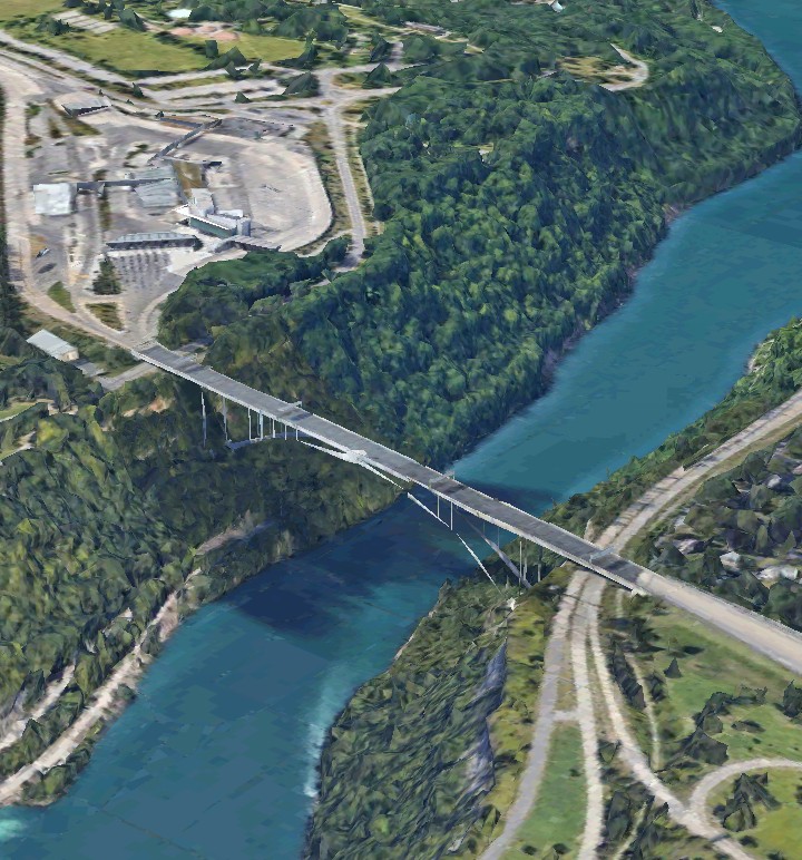
All images in this posting are from Google Earth or Google Maps, unless otherwise specified.

I use markup, usually red, to indicate the feature that I am referring to. It would, of course, be helpful if you followed along in your own atlas or Google Earth app.

My geology theory introduces a scenario that leaves no major feature of the earth's surface, either on land or on the seafloor, unexplained. This is the earth as it has never been explained before. Let's begin with the story of the theory. 

In 2009 my late brother, Paul, gave me a world atlas. I had always been interested in global geography. I was a young boy, having come from England and living on the Canadian side of Niagara Falls, when my parents got me an atlas to show me where we had come from. I went all through the atlas and had a good knowledge of world geography at a young age. I always had a world atlas while growing up and would look to see where a place was when it was in the news.

This atlas that I was given in 2009 was a physical geography atlas. Most of the atlases that I had before were political atlases, with each country in a different color. In this atlas the emphasis was on mountains and the elevation of the land. There were very detailed maps of the seafloor, which had only recently become available.

I had done writing about natural history, particularly about the Niagara area where I lived. There was something in the atlas that I began wondering about. It was the Szechwan (or Sichuan) Basin of southwestern China, where the cities of Chungking and Chengdu are located. 

How could this basin have possibly formed? It was a vast, nearly circular, flat area with low mountains around it and much higher mountains not far away. 

All images that I use in this theory are from Google Earth, Google Maps or, Google Street View. Colored markup, usually red, is used to point out the feature that I am referring to.

There was another vast basin in the world, the Congo Basin in Africa. That was easier to explain. There was hot molten rock inside the earth, known as magma. When it emerges from a volcano it is known as lava. The heat comes from the continuous decay of radioactive elements inside the earth and probably heat energy left over from the formation of the Solar System. The spin of the earth would cause magma to emerge along the equator by centrifugal force. This would spread the land above it apart and form the Congo Basin. The spin of the earth was clearly always causing magma to rise from below, and it shapes the surface of the earth. We only see it when it emerges from a point, known as a volcano.

It also became apparent that magma does not emerge only along the equator. The laws of fluid dynamics seemed to dictate that it must also emerge along longitudinal lines. The most obvious such longitudinal line of magma emergence was the Mid-Atlantic Ridge. This is what causes the Atlantic Ocean seafloor to spread, which is what has pushed the eastern and western hemispheres apart. It is known that South America was once joined to southern Africa and the Appalachian Mountains were formed by a sliding collision between what was once North America and what was once Africa. Volcanic activity split it apart and the Atlas Mountains of Morocco were once part of the Appalachians. America east of the Appalachians was once part of Africa. Earthquakes along the west coast of the western hemisphere area caused by the continents being pushed against the Pacific Plate.

This is the Mid-Atlantic Ridge. Iceland is formed by the ridge poking above the surface of the water and we can see the magma emergence by the frequent volcanic activity there.

The Mid-Atlantic Ridge is not the only longitudinal line of magma emergence. On the floor of the Indian Ocean there are two ridges that are parallel and virtually perfectly longitudinal. At left is the Chagos Llacadive Ridge and at right is the Ninety East Ridge.

What I noticed is that, if the Great Rift Valley of east Africa is actually a longitudinal line of magma emergence, then the southern portion of the Mid-Atlantic Ridge, the Great Rift Valley, the Chagos Llacadive Ridge and, the Ninety East Ridge are just about evenly spaced. Magma emergence does not necessarily mean that there will be a volcano. If the emergence is smooth and even then there will be no volcano. A volcano forms when there are some special circumstances so that the magma breaks through to the surface at one point.

Then I noticed something amazing about what I had originally wondered about, the Szechwan Basin of southwestern China. There was a very broad longitudinal valley in Burma, through which the Irrawady River flowed, that looked like it might be a longitudinal line of emergence. It pointed right toward the Szechwan Basin, although there was high mountains between the two.


It became clear that there was one thing preventing these patterns of magma emergence from being more predictable. That one thing was the Pacific Plate. The earth's surface consists of twenty or so tectonic plates. I believe that they formed when the earth's surface cooled, and shrank, faster than the interior. 

There is actually a longitudinal line of emergence system that extends across the world, missing land and going around the Pacific Plate. I call it the W-Line because it roughly has the form of a W. The portion to the left is the Mid-Atlantic Ridge. When it meets North America, at right, it forms the Gulf of California and Central Valley.

It is the shifting of these tectonic plates, driven mostly by the spin of the earth, that causes the most powerful earthquakes. The plates are far from equal in size but by far the largest and heaviest one is the Pacific Plate, which forms the vast Pacific Ocean. As a general rule continental land masses can slide over these plates, but the Pacific Plate seems to be the exception. Magma also has more difficulty emerging through the Pacific Plate.

Another mystery about the earth soon became apparent. This was perhaps the greatest mystery of all. Where did all of these mountains come from? There are mountains all over the world but only a limited portion of them have been explained.

Mountains are explained as being the result of either tectonic collision or volcanism. Ranges of volcanic mountains, like the Apennines as opposed to a standalone volcano, tend to be low and rounded. Collision mountains, like the Alps and Himalayas, tend to be higher and with sharp peaks. If it is more of sliding collision, like the Appalachians, the mountains will be lower but there will be extensive ridges.

Any of those methods will tend to form mountains in lines. There is really no explainable reason for mountains to exist in non-linear masses.

All along east Africa are mountains, also southern Africa and Madagascar. But how could they have formed? Kilimanjaro is a standalone volcano but the rest are not volcanic and couldn't possibly be collision mountains. You can see the Congo Basin that I referred to earlier in dark green along the equator.

How about the Great Dividing Range of Australia, and also the mountains of New Zealand? These are not volcanic or collision mountains either. The Great Dividing Range looks like it just might be the result of a sliding collision, like the Appalachians, but it doesn't have the ridges and there is no evidence that Australia collided with anything on its east coast. The Great Dividing Range includes Tasmania, which has broken off.

Then we come to Antarctica. It is almost all mountains. In fact, it is by far the highest in elevation of all the continents. As a general rule the larger a continent is the higher it's average elevation. But Antarctica is about twice as high as Asia, even though it is a relatively small continent. Antarctica is a mass of mountains, completely non-linear. It is known that Antarctica was not always at the south pole but how on earth could these mountains have formed?

The greatest mass of unexplained mountains is the one that extends from Greece, through Turkey and Iran, and all across central Asia.

To add to the mysteries of these mountains we have the Caspian and Black Seas. The Caspian Sea is salt water, meaning that it must have been connected to the oceans at one time. But now it is completely cut off by these unexplained mountains, and the Black Sea is almost completely cut off. There is salt desert in Iran, meaning former seafloor that was forced upward.

Then we have the rocky islands of the far north. These are certainly not of volcanic origin so where did they come from?

There is Greenland and the rocky islands in the far north of Canada, as well as the mountains of Alaska.

There is the Scandinavian Mountains.

There is the rocky north of Siberia, such as the Taymyr Peninsula.

Where could have these rocky land masses have come from?

The general opinion about the formation of the moon is that, early in the earth's history, it was struck by an object about the size of Mars. The shattered pieces of the object were hurtled into space where they gradually coalesced by gravity to form the moon. This makes perfect sense but I had never seen it explained that some of it might have remained on earth and formed the continents.

The same side of the moon always faces earth. The dark "seas" that we see on the moon, which are actually lava plains, are only on the side of the moon facing earth. These are clearly formed from the tidal effect of the earth's gravity causing lava to flow in the distant past. But this would make it logical for the lava emergence to be concentrated along the moon's equator. You can see in the following image, from the Wikipedia article "Moon" that the "seas" are mostly in the northern hemisphere. But we do see a line of "seas", indicated by the red dots, that makes it look like what was once the equator has shifted northward.

The largest known impact crater in the Solar System is the Aitken Basin, at the moon's south pole. But what are the chances that this largest known impact crater would be right at the moon's south pole? Isn't it more likely that the impact upset the moon's rotation, by either adding or removing mass, and then the moon rebalanced it's rotation by shifting on it's axis so that one of it's poles was at the impact site? This also explains why the "seas" are mostly in the moon's northern hemisphere when they logically should have been centered along the equator.

We can see the same effect on Mars. The southern hemisphere of Mars is higher in elevation, and thus heavier, than the northern hemisphere. The only way to avoid having this unbalance the planet's rotation is to have one pole centered in the heavier hemisphere and the other in the lighter hemisphere.

This idea of "Theia" colliding with the earth and the fragments coalescing to form the moon is widely accepted. But I had never seen it used to explain the continents and this vast array of unexplained mountains. Isn't it logical that some of the mass of Theia would have remained on earth? This would explain the continents, including all of these otherwise unexplained mountains.

The continents must have come from somewhere. There is a reason for thinking that the continents must have come from outside, rather than from within the earth. Some lands are of volcanic origin, rather than continental. Some examples are Cuba, the Philippines and Japan. The continents move tectonically, driven by the spin of the earth, but the lands of volcanic origin do not. The reason is that the volcanic lands are part of the earth while the continents are additions from outside and an equilibrium hasn't quite been reached yet.

But the added mass might cause the earth to shift on it's axis, in the same way as the moon and Mars. The added continental mass wouldn't be much, relative to the mass of the earth, but being on the surface would give it more angular momentum due to the earth's rotation.

We saw above that magma naturally emerges along the equator, due to the centrifugal force of the spin of the earth and promoted by the added weight of the continents, and this has to be balanced by corresponding longitudinal lines of magma emergence. The best known line of longitudinal emergence today is the Mid-Atlantic Ridge. That would change if the earth had shifted on it's axis, due to the added mass, but we might be able to see traces of former equators or longitudinal emergence lines.

What I found is that the earth has shifted on it's axis three times, due to impacts that formed the continents, and not only can we still see traces of this but it leaves no major feature of the earth's surface, either on land or the seafloor, unexplained. Instead of one "Theia" there were three separate what I call "Continental Asteroids". It is probable that "Theia" broke apart in earth orbit and struck the earth in three separate pieces, millions of years apart. This very well explains the surface of the earth that we see today.

The longitudinal lines of magma emergence converge at the poles so that we should expect to see some kind of ridge structure in the Arctic Ocean, and indeed we do.


At the bottom right of the above image you can see how a perfectly straight line of emergence extends southward from the Arctic Ocean and separates Greenland from the islands of the Canadian Arctic.

In the Arctic the ridge structure can also be seen in a line perpendicular to the one between Greenland and the islands that forms a perfectly straight line passage through the islands of the Canadian Arctic.

It is actually a branch from the Mid-Atlantic Ridge that forms the channel separating Greenland from the islands of the Canadian Arctic, represented by the red line. This forms an intersection with the two other lines. Iceland is formed by the Mid-Atlantic Ridge poking above the surface of the water.

If the earth didn't have the continents where might it's poles be? Remember how the moon and Mars balance their rotation by having a pole centered on any difference in mass. We know that the Pacific Plate is by far the largest and heaviest tectonic plate. Unlike the other plates continents are not able to cross it and this is what creates the vast Pacific Ocean, which is larger than all land combined. 

The usual magma emergence has difficulty getting through the Pacific Plate. It finally breaks through in places which is why the Pacific Ocean tends to have lines of small volcanic islands instead of ridges on the seafloor. Coral atolls are where coral builds up on extinct volcanoes until it reaches the surface. Magma doesn't only emerge along these longitudinal lines and the equator, but also through the gaps between the tectonic plates. The volcanic "Ring of Fire" around the Pacific Ocean is caused by the tremendous weight of the Pacific Plate forcing up magma around it's edges.

So we might expect that one of the poles of the earth before the continents were added would be right in the middle of the Pacific Plate. Since lines of magma emergence converge at the poles, as we saw in the Arctic Ocean and the Canadian Arctic above, we might expect to see a line of islands around the former pole.

Sure enough, the Hawaiian Islands are right in the center of the Pacific Plate. The magma emergence is still active today, but as lines of islands that have broken through instead of ridges because the plate is so thick. Mauna Kea and Mauna Loa are actually the highest mountains in the world if their underwater portion is included.

Can you believe that Hawaii was once the north pole? It is not as unusual as it might seem, we know that Antarctica was once tropical. But if Hawaii was the north pole then the corresponding south pole would be the Kalahari Basin in what is now southern Africa. 

Geological processes change very slowly. Magma continues to emerge from former equators and longitudinal emergence lines long after the earth's rotation has shifted, and some emergence may still be taking place today. Magma emergence tends to form ridges if on the seafloor, or lines of islands on the Pacific Plate, but to spread land apart, forming a basin or broad valley if under land. Magma emergence may be curtailed if a heavy mass of continental mountains above it. It may break through at one point as a volcano.

So in the days before the continents the south pole was at what is now the Kalahari Basin and the north pole was at what is now Hawaii, in the center of the massive Pacific Plate to balance the earth's rotation. But then the First Continental Asteroid landed and the earth's rotation had to shift in order to balance the new mass.

The south pole moved to what we see as this ridge structure in the south Atlantic Ocean. Notice how similar it looks to the ridge structure that we saw around the Arctic Ocean. 

The north pole moved to this similar ridge structure in the north Pacific Ocean. Notice how the line of mountains, which form islands if they reach the surface, extends westward from Hawaii and forms an intersection, similar to the intersection that we saw near the Arctic Ocean. This is caused by longitudinal lines of emergence converging. The prominent line at the top is the boundary of the Pacific Plate and not one of these lines of emergence.

The non-volcanic mountains and high ground of eastern and southern Africa might be a remnant of this First Continental Asteroid.

Then the Second Continental Asteroid landed and the poles had to shift again, in order to balance the added mass. The south pole shifted and formed a new ridge structure, the undersea Mascarene Ridge around Madagascar.

The high ground of the island of Madagascar may well have been part of the Second Continental Asteroid that didn't get pulled away by the spin of the earth. It is widely believed that India was once joined to Madagascar. Also I have long been intrigued by how the west coast of Australia fits perfectly with the east coast of India. This would indicate that Madagascar, India and, Australia were part of the Second Continental Asteroid.

Look at how neatly Madagascar fits with the west coast of India and Australia fits with the east coast of India, as indicated by the red dots.


When the south pole moved to the Mascarene Ridge the north pole moved to the Great Basin in the western U.S.

When magma emerges under what is now dry land it tends to pull the land apart, creating a basin, as opposed to ridges on the seafloor. This is why the Great Basin is similar to the Kalahari Basin in Africa. Some magma emergence is still going on below the Great Basin and it provides the heat for the geyser "Old Faithful", in Yellowstone National Park.

We know that the Rocky and Andes Mountains are collision mountains, formed as North and South America is pushed against the Pacific Plate by the spreading of the Atlantic seafloor from the Mid-Atlantic Ridge. In Canada and South America the mountains are right against the coast.


So then why are the Rocky Mountains in America so far from the coast. They formed by collision also and look very much like tectonic collision mountains. It is because they were pushed backward by continuing magma emergence from the Great Basin.

Finally the Third Continental Asteroid landed. This was by far the largest of them all. It seems to have struck the earth at a somewhat low angle. It's primary impact site was Antarctica, and this is where the south pole moved, in order to balance the added mass. This also explains why Antarctica, almost all mountains, is by far the highest in elevation of all the continents. The north pole shifted from the Great Basin to where it is now.

The mass from this Third Continental Asteroid includes the vast ranges of unexplained mountains from Greece, through Turkey and Iran, to central Asia. It also includes all of the rocky mountains and islands in the far north, from the mountains of Alaska to the islands of the Canadian Arctic, to Greenland. Again this explains how the Caspian Sea, which is salt water, ended up being separated from the global ocean, of which it must once have been a part, by a vast range of unexplained mountains.

We can trace the "trail" of the north pole as it moved from the Great Basin to it's current location. This trail begins with the Snake River Canyon, proceeding eastward. 

Just look at Hudson Bay, with James Bay extending to the south. Doesn't it look like the north pole passed through with the pole within Hudson Bay and James Bay extending to the south as a longitudinal line of emergence? The pole proceeded north, forming the Foxe Basin (red dot). This left a basin that the glaciers excavated during the ice ages.

At the same time we can see the ridge structure on the sea floor (red dot) that was the trail as the south pole moved from the ridge structure around Madagascar (green dot) to the present south pole in Antarctica (purple dot).

As the poles were shifting, due to the added mass of each Continental Asteroid, the equator must have been shifting too. Magma emergence along the equator, by the centrifugal force of the earth's rotation, would form a valley on land or a ridge on the seafloor. There is a place in the world where we can see all four equators.

The first equator is before any Continental Asteroids had landed. The north pole was at Hawaii and the south pole at the Kalahari Basin.

The second equator is after the First Continental Asteroid had landed. The south pole was in the south Atlantic Ocean and the north pole was in the north Pacific Ocean.

The third equator is after the Second Continental Asteroid had landed. The south pole was the ridge structure around Madagascar and the north pole was the Great Basin of the western U.S.

The fourth, and present, equator is after the Third Continental Asteroid had landed. The poles moved to where they are now.

All four equators show up as undersea ridges off the west coast of South America. These equators are all perfectly positioned to match these sets of poles. Where the third and fourth (present) equators meet it forms the Galapagos Islands. The first equator is faint. There is a red dot on each equator.

You can see how this matches the shifting of the poles, as described above. The top image is the south pole and the bottom image is the north pole. The compass bearing is the same in both images so the "Z" that is formed is reversed.


There are two great areas of volcanoes and magma emergence in the world, where many islands have formed. These are the East Indies and the West Indies. The East Indies are around Indonesia and the West Indies are the Caribbean. Has anyone ever wondered why they are on nearly diametrically opposite sides of the world? It is because they are where all of the equators come close to meeting.

I noticed two rules concerning tectonic collisions between continental land masses. 

The first rule is that such collisions occur between land masses from different Continental Asteroids. Just the fact that such collisions occur tells us that the land masses must have come from different places. Land mass from the same Continental Asteroid would have the same momentum, making collisions unlikely. The nearby Appalachians formed by a collision between what was then North America, based on the Third Continental Asteroid, and what was then Africa, based probably on the First Continental Asteroid.

The second rule concerns the flow of major rivers. The earth rotates eastward and the momentum of this spin should affect major rivers to flow either eastward or toward the equator, and most major rivers do. But the Nile and Rhine Rivers flow northward, away from the equator. The Narmada River flows westward. The Niagara River flows both northward and westward. The rule is that in order for a river to oppose the rotational momentum there must have been a tectonic collision.

There is another factor in shaping the surface of the earth and that is the impacts of comets. It is virtually certain that the water and salt on earth came from comet impacts.

How could western Europe have formed? 

There is the vast range of unexplained mountains from Greece to Turkey and Iran through central Asia. But there is a gap between Greece and Turkey, which forms the Aegean Sea.

The mountains of Italy are different, lower and smoother, and there are several volcanoes. That is because Italy is of volcanic origin.

How do we get a tight loop of volcanic land with a deep sea in the middle? There is apparently nothing like this anywhere in the world. But what must have happened is simple. A comet, moving southeast, struck in what is now the Tyrrhenian Sea, causing magma to emerge that formed the land.

Then this provides an explanation of why Greece seems to have been "pulled apart" from Turkey, leaving the Aegean Sea as the gap. It was pulled apart by the force of the impact of the comet. The many islands in the Aegean Sea are the "crumbs" that were left behind.
 
But then this also provides an explanation for so much of Europe. The line of mountains across Iran, Turkey and, Greece had actually extended further west. It all came from the Third Continental Asteroid. The comet actually struck the line of mountains, breaking it into pieces. The pieces floated all over tectonically and make up much of Europe today. 

The single largest such piece drifted tectonically northward and forms the Scandinavian Mountains.

On the east side of the Adriatic Sea the line of mountains from Asia seems to continue, but at an angle of about 45 degrees. This is also explainable due to the impact of the comet.

Various other pieces of this line of mountains, which I refer to as the Original Impact Line, drifted around tectonically, forcing up seafloor between them and creating the land of Europe. These include the Massif Central of France, the Balearic Islands, Corsica and Sardinia.

Ireland is composed of several such pieces and the former seafloor that they have forced up between them.

These broken pieces of the Original Impact Line can get caught on longitudinal lines of magma emergence. Notice how Sardinia and Corsica form a perfectly straight north-south line. Have you ever thought that Britain, in terms of geology, looks like a jumble of pieces that don't quite fit together? That's exactly what it is.

Broken pieces of the Original Impact Line got caught on a longitudinal line of emergence. Notice that the Pennine Mountains of northern England form a straight line with the Contentin Peninsula of northern France.

Volcanic land mass usually doesn't move tectonically because it came naturally out of the earth. Italy, although it is volcanic, did move tectonically, for the same reason that the continents do, it was imposed from outside by the comet impact. Italy collided with Europe to form the Alps. It also displaced a section of the Pennines westward to form the Cambrian (Welsh) Mountains. I find it likely that the Rhine and Rhone Rivers were once one river until severed by this impact.

How did the straight line across northern Scotland, known as Glen Mor, form? A piece of the Original Impact Line fractured as it collided with the longitudinal emergence line that forms the Pennines.

Could this comet impact in the Tyrrhenian Sea, that so shaped the surface of the earth have occurred anywhere else? What about the Sea of Japan? We have a very similar situation except that there are no shattered pieces of the Original Impact Line. Japan is volcanic while nearby Korea is not. How did a very mountainous peninsula like Korea come to be? A comet impact in the Sea of Japan caused a lot of magma to emerge, forming Japan. It tore a mountainous section away from the mainland, forming Korea. The Sea of Japan is congruent to the Tyrrhenian Sea. Japan is congruent to Italy. Korea is congruent to Greece. The Yellow Sea is congruent to the Aegean Sea.

EXAMPLES OF HOW THIS THEORY WORKS

The remainder of this posting is a few examples of how this theory works.

Look at how the Red Sea forms a straight line with the Mascarene Ridge structure around Madagascar. That's because what is now the Red Sea began as a longitudinal line of emergence in the previous polar era.

The Red Sea is actually still a longitudinal line of emergence in the present polar era because the Great Rift Valley Links to it and the Red Sea is still widening.

The Indus Valley of Pakistan also forms a straight line with this ridge structure around Madagascar and began as a longitudinal line of emergence in the previous polar era.

The axis of the Caspian Sea also leads directly to this ridge structure around Madagascar.

The Narmada Valley across India, through which the river of that name flows, was once the equator when the equator was shifting to it's present position. Notice that it forms a straight line with the Gulf of Aden, which leads to the Red Sea.

There is a bulge on the west coast of Mexico that is composed of the mountain range Sierra Madre Del Sur. It begins at Puerto Vallarta, in the north, and continues past Acapulco. This bulge is at the same latitude and is the same length and width as Cuba. We know that Cuba is of magma emergence origin but Mexico is part of the continent that is moving westward as the Atlantic seafloor widens along the Mid-Atlantic Ridge. Doesn't it look like Mexico picked up the former Cuba but then Cuba formed again after Mexico had passed?

Why is Venice sinking? Has anyone ever noticed that the axis of the Adriatic Sea forms a line with the axis of the Red Sea? That's because it was part of the same longitudinal line of emergence in the previous polar era. The Po Valley, across northern Italy, was part of the equator in that era. There is still some emergence going on in both and this spreads the land apart. Venice is right at the intersection of the two and that is why it is sinking.


The Mid-Atlantic Ridge is a longitudinal line of emergence in the present polar era. But it is composed of several different lines.

Section 1 is a former equator from two polar eras ago, after the First Continental Asteroid. It forms a line with the Nazca Ridge, extending from the west coast of South America, which we saw was the third equator.

Section 2 forms a line with Cuba in one direction, which continues on to the Great Basin, and forms a line with the ridge structure around Madagascar in the other direction.

Section 3 is the magma emergence along the present equator. There is the Amazon Basin on one side and the Congo Basin on the other. Lake Victoria is also along this line and equatorial magma emergence explains why a lake of such high elevation could be the second largest lake in the world.

Tambora was the titanic volcano eruption in 1815 that affected the whole world. Notice how the Strait of Malacca, which is perfectly positioned to be a former equator points directly to it. Tambora is where the present and former equators meet, an ideal place for a volcano.

Manhattan Island is much longer than it is wide. Notice that the ratio of it's length to it's width is just about exactly the same as the ratio of the width of the East River to that of the Harlem River. Also that neither river really serves any hydrologic function, meaning that it wouldn't have been formed by flowing water. And how did the island in the middle of the East River form? The answer is that Lake Champlain and the Hudson River occupy a longitudinal line of magma emergence, Manhattan is the result of magma emergence and the two rivers are cooling channels, formed when Manhattan cooled and shrank. The red dot is Manhattan, the upper purple dot is the Harlem River, the lower purple dot is the East River.


When a line of magma emergence runs beneath rocks from a Continental Asteroid it typically pulls the land apart to form three parallel peninsulas. Here are four examples. From top- the Peloponessus in southern Greece, near the Greek city of Thessaloniki, southwestern Ireland, Canada's Baffin Island.


This is the earth like it has never been explained before.