Thursday, December 25, 2025

Iceland

The island of Iceland was settled by Vikings in the Ninth Century. There are no aboriginal people in Iceland but many people believe that Irish monks were there before the Vikings. The capital and largest city of Reykjavik was founded in 1785. Iceland became independent of Denmark, which had ruled it since 1380. It was a monarchy, ruled in a personal union with Denmark, from 1918-44. A personal union means that two countries are ruled by the same king, although that does not mean that the two are completely united.

An overlooked fact about Iceland is that it's parliament, the Althing, is nearly 1100 years old and is likely the oldest parliament in the world. Iceland is today one of the most prosperous countries. It is not always as frigid as the name implies and it is sometimes said that Iceland and Greenland should switch names.

In cultural terms, Iceland is considered as part of Scandinavia and has a Nordic Cross flag like the others. The cross represents Christianity. The Danish flag is the oldest unchanged flag in the world and was where the Nordic Cross originated on the flags. The following image is from the Wikipedia article "Nordic Countries".


The flags are, from top to bottom, Denmark, Finland, Iceland, Norway and, Sweden.

England's medieval history originally focused on connections abroad with Scandinavia. Winchester was the capital of the North Sea Empire. But this was changed with the Norman Invasion from Normandy, in 1066, although the Normans had originally been Vikings.

During the Cold War, Iceland sometimes served as a neutral ground where the two sides could meet. Iceland hosted the 1972 chess tournament between Bobby Fischer and Boris Spassky. In 1986, it was where Ronald Reagan met with Mikhail Gorbachev.

Laugavegeur is a main street in central Reykjavik. The very tall church is the Hallgrimkirkja but, like the rest of Scandinavia, you can see that Iceland is not very fond of skyscrapers. The first nine images of the area are from Google Earth and Street View.


There are multiple scenes following. To see the scenes, after the first one, you must first click the up arrow ^, before you can move on to the next scene by clicking the right or forward arrow, >. After clicking the up arrow, you can then hide the previews of successive scenes, if you wish.


Iceland is at high latitude and you can see how long the shadow of the church is. I can't find anything about it but I wonder if these blocks, upon which the shadow falls, act as a sundial.


https://www.google.com/maps/@64.1289849,-21.9180033,3a,60y,90t/data=!3m6!1e1!3m4!1sgoicxi69kLBxcX_21a3Ldw!2e0!7i13312!8i6656

Here is everyday Reykjavik, away from the central city. The first two images are from Google Street View.


https://www.google.com/maps/@64.1106461,-21.8863045,3a,75y,80h,100t/data=!3m8!1e1!3m6!1sCIHM0ogKEICAgIDuuMevcg!2e10!3e11!6shttps:%2F%2Flh3.googleusercontent.com%2Fgpms-cs-s%2FAPRy3c-Slu-9nEMZqzkIpQsdwSFf_hTVvjViDob4AAj4dbWbVbWuTdIrwatErMEpTjtzb1KakzX6RJAqAJ6efuKytOQ6DonX9md7PRrFsizvfN41n7rIEaKYVOpmQ1O1tZ3r_Yq0ytRv%3Dw900-h600-k-no-pi-10-ya160.2604370117188-ro0-fo100!7i5760!8i2880?authuser=0&entry=ttu&g_ep=EgoyMDI1MTExMi4wIKXMDSoASAFQAw%3D%3D

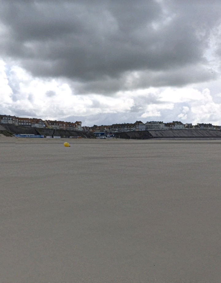
Iceland is not all about Reykjavik, even though it is it's only large city. Iceland is also known for it's spectacular natural landscapes. Geologically, Iceland is where the Mid-Atlantic Ridge pokes above the surface of the water. Since the Mid-Atlantic Ridge is continuously forming, that means that Iceland is volcanic in origin and new islands are still being formed. This is a look at a town and natural scenery far in the interior of Iceland.

https://www.google.com/maps/@65.6387388,-16.910534,3a,75y,220h,90t/data=!3m8!1e1!3m6!1sAF1QipPmH3tWjmyxU58M7evBqH224zlej-xjr6WBL_Zd!2e10!3e11!6shttps:%2F%2Flh5.googleusercontent.com%2Fp%2FAF1QipPmH3tWjmyxU58M7evBqH224zlej-xjr6WBL_Zd%3Dw203-h100-k-no-pi-20.64289-ya157.22691-ro-4.8715734-fo100!7i5376!8i2688

In the north of Iceland, far away from Reykjavik, is the city of Akureyri. The first four images of Akureyri are from Google Street View.


The English Channel Isthmus And Scandinavia

On the subject of Scandinavia, although this does not apply to Iceland, has anyone noticed something interesting about the beaches along the English Channel? On both the French and English sides the beaches alternate between being sandy and Stony. This is because, before the last ice age, there was an isthmus connecting the two countries.

Rock is broken down into sand by the action of waves, but it takes a very long time. The ice age ended about twelve thousand years ago and that is not enough time to completely break the rock into sand. In the following image, from Google Earth, the enclosed area is the approximate location of the former isthmus.


Scandinavia, as well as Britain, are warmed by the Gulf Stream. This is a cury of warm water that originates in the Western Hemisphere. In the following image, from Google Earth, the red arrow shows how the Gulf Stream flows through the English Channel toward Scandinavia, which is in the upper right.


If the English Channel was blocked, as it was by this isthmus before the last ice age, Scandinavia would be much colder than it is today, although Britain would still be warmed. This means that Scandinavia has only been as warm as it is since the last ice age.

Let's have a look at evidence of the former English Channel Isthmus.

At Folkestone, near the eastern end of the English Channel on the England side, the beach is sandy.


But if we continue westward to Hastings, the beach becomes stony.


Further west, at Eastbourne, the beach is still stony.


At Brighton, the stony beach continues.


At Bognor Regis, there is still a stony beach.


But low tide at Bognor Regis reveals sandy beach further from shore.

However if we continue west to Bournemouth, past the Isle of Wight, the beach goes back to being sandy.


On the French side of the English Channel, the beach at Boulonge Sur Mer is sandy.


But if we move westward along the coast, the beach at Sainte Valery En Caux is stony.


Continuing westward, the beach at Fecamp is still stony.


But if we continue west to Le Havre, the beach goes back to being sandy.


The reason is that France and Britain were connected by land, but the last remaining isthmus between the two was swept away by moving glacial ice during the last ice age. Sand comes from the action of waves gradually breaking down rock into particles, over long periods of time. The stretches of stony beach, which is longer on the English side, are areas that only became beaches with the last ice age, which ended about twelve thousand years ago.

There has not been enough time since then for the waves to break the rocks on the beach completely down into sand. The rocks have been broken down into small pebbles, but not yet into sand. The areas of sandy beach have been beach for much longer.

The reason that there is sandy beach visible at low tide at places such as Bognor Regis is that the beach was not suddenly cut away by glacial ice there. The rock has been gradually being broken down by waves. Ice age movement of glacial ice will break loose some rock from higher ground above the beach, and the waves will proceed to gradually break it down.

Places In The Bible

Merry Christmas to readers.

Here are links to postings about places in the Bible. Links have been updated to images in the postings.

"Esau And The Temple Mount"

www.markmeeksideas.blogspot.com/2016/02/esau-and-temple-mount.html?m=0 

"The Tomb Of The Patriarchs"

www.markmeeksideas.blogspot.com/2017/05/the-tomb-of-patriarchs.html?m=0 

"Archeological Sites In The Holy Land"

www.markmeeksideas.blogspot.com/2024/12/archeological-sites-in-holy-land.html?m=0 

"The Holyland Model Of Jerusalem"

www.markmeeksideas.blogspot.com/2025/01/the-holyland-model-of-jerusalem.html?m=0

Scandinavia And The French Revolution

The French Revolution was the beginning of the modern political era. The king and queen were overthrown, and guillotined, with the intention of creating a republic, where the people rule themselves and the president or prime minister is like a hired manager. But the revolution ended up in the rule of Napoleon, who was the prototype of the modern dictator although that was not the intention. An example of the influence of Napoleon is that the revolutionaries created the Metric System and his enthusiasm for it is why the world is using it today.

The French Revolution has swept the world. There have been two major, and numerous minor, reenactments of it. What I mean by major reenactments is where the basic direction of the revolution was changed. 

The first major reenactment was the October Revolution of 1917. The royal family of Russia was overthrown and executed, in favor of Communism. The original French Revolution was political, this changed the direction to economics. 

The second major reenactment was the Iranian Revolution of 1979. The original and first reenactment of the French Revolution had been away from religion. The Iranian Revolution turned the direction back toward religion, and not just Islam. Unlike the first two the royal family of Iran, the Shah, were overthrown but managed to escape.

One common factor in reenactments is some reenactment of the Storming of the Bastille. This was the signature event of the French Revolution. The October Revolution had the Storming of the Winter Palace as it's signature event and the Iranian Revolution had the Storming of the U.S. Embassy.

The French Revolution, and it's tremendous influence on the world, is described in detail in the book-length compound posting, "America And The Modern World Explained By Way Of Paris", December 2015.

During the recent weekly visits to Scandinavia, I noticed how the French Revolution had played out there.

Sweden had been a great power and had ruled neighboring Finland for six hundred years. It had lost great power status following a defeat by Russia in what is now Ukraine. This was the beginning of Russia as a great power, but Sweden still ruled Finland and had joined the coalition against Napoleon. Russia later gained control of Finland and moved the capital from Turku, which faced toward Sweden, to Helsinki, which was closer to the Russian capital of St. Petersburg.

Russia had also been invaded by Napoleon. The invasion was ultimately unsuccessful but the October Revolution, more than a century later in 1917, was virtually a mirror image of the French Revolution that had ultimately resulted in Napoleon coming to power. The overthrow and execution of the Tsar in Russia resulted in a civil war between the Reds, the Communists, and the Whites, a coalition of their opponents. The Reds won in Russia, but the Whites won in Finland and it managed to gain independence from Russia.

Unlike the other Scandinavian countries, Finland had not been a monarchy itself because it had been ruled by first Sweden, and then Russia. What is interesting is that Sweden had earlier elected a foreigner as their king, a French veteran of the revolution and then one of Napoleon's top officers named Jean-Baptiste Bernadotte. His descendants are still the royal family of Sweden.

Following it's independence in 1917, a brief attempt was made to establish a monarchy in Finland. In a similar way as Sweden, a foreigner was elected as king. The Kaisers still ruled Germany and had helped the Whites to win the civil war in Finland. A member of the Kaisers' family was elected as king of Finland. But it was never implemented and the Kaisers were overthrown not long afterward.

The idea of choosing a foreigner as king is primarily so that no faction in the country will rule over the others. It was actually a Viking named Rurik, likely from Sweden, who was chosen to rule over Russian tribes who had difficulty getting along with each other. The descendants of Rurik would rule for centuries, first the state known as Kievan Rus and then the successor nations of Russia, Belarus and, Ukraine. The Rurikids ruled Russia up until the time of the Romanovs.

But the French Revolution played out in Scandinavia in that, while Denmark, Sweden and, Norway were monarchies, Finland chose a Napoleonic figure. Marshal Carl Mannerheim was very much in the mode of Napoleon, a leader in a military uniform who is considered as the "father" of modern Finland.

Civilization And Time

It is generally believed that human civilization began with the development of the ability to write, to record information. To get to this phase with permanent settlements, in contrast to the earlier nomadic hunting and gathering of food, two vital steps are acknowledged to have been necessary: the growing of crops and the control of fire.

At some point, nomadic pre-historic people noticed that if they dropped the part of food plants that we today call seeds and then happened to pass by the spot later, duplicates of the plant would be growing. This was the beginning of agriculture and is recognized as the most important of the two vital steps in the beginnings of civilization by making permanent settlements possible by eliminating the necessity of wandering in search of food.

The other of these two vital early steps was the control of fire. This made the cooking of food possible and also provided heat and light. Maintaining a fire at a settlement kept wild animals away and, in time, people would discover that it made the smelting of metals from ores possible.

However, I would like to add a third vital step in the beginning of civilization to the first two. It is the measurement of time. Without this step, civilization would have been impossible, regardless of the other two.

First of all, any kind of sustained agriculture would be impossible without an understanding of the seasons. Fortunately, we have a ready-made seasonal timepiece, the moon, with it's predictable phases. The moon orbits the earth, while going through it's series of phases, in twenty-nine days. I am certain that we are greatly underestimating the importance of this to the beginning of human civilization. Early agriculture, which was the very basis of civilization, was completely dependent on the convenient measure of time provided by the moon.

When the Industrial Revolution came along, I do not believe that it's centerpiece was the steam engine, as is generally believed. My hypothesis is that it relied upon the development of reliable and accurate clocks. Indeed, the workings of a steam engine bears a similarity to that of pendulum-based clocks, which came first.

In agriculture, the most important measure of time is the calendar. It is the cycle of the seasons that is important to the farmer. The time of day is unimportant, whether the farmer plows or plants in the morning or in the evening makes no difference whatsoever.

But when the Industrial Revolution comes and people are working in factories rather than on farms, it is the clock, rather than the calendar, which is most important. If a factory laborer must report to work at 4 PM to replace the worker on the previous shift, it is the exact time of day that counts, the season is unimportant. Regardless of progress in other areas, the Industrial Revolution would have been impossible without accurate clocks and the development of such clocks brought about the mechanical skills to build the steam engines and other features of the Industrial Revolution.

Global navigation also relied upon the development of accurate clocks that were not dependent upon the movement of a pendulum. It is easy to measure the latitude of one's location by the angular altitude above the horizon of the North Star, or the equivalent point in the southern hemisphere. But measurement of longitude is more difficult and was solved by carrying an accurate clock on a ship set to Greenwich Mean Time (GMT) and comparing it to locally measured solar time. Pendulum-based clocks are not reliable on ships at sea because the rolling and pitching of the ship in rough waters interfered with the operation of the pendulum.

The progress that human beings can make depends upon our mastery of the smallest essential time frame involved. This goes for both technology and scientific discovery. Time is the fundamental dimension and it is the most important quantity of which we take measurements. Humans have mastered nuclear reactions and can build computer CPUs only because we have mastered the required time frames. We have not mastered the electron orbitals around an atomic nucleus and still consider them as governed by uncertainty simply because we cannot yet handle the time frame involved.

For more about the development of civilization see "Prehistoric History", August 2025.

Nuclear Technology In New York State And Ontario

An agreement was announced that New York State will cooperate with the Canadian province of Ontario to develop an advanced nuclear power capacity for generating electricity. Most of Canada's nuclear reactors are in Ontario.

Why don't we review the posting explaining nuclear technology, "General Thoughts About Nuclear Issues"? Here is a link to it.

www.markmeeksideas.blogspot.com/2025/06/general-thoughts-about-nuclear-issues.html?m=0

Thursday, December 18, 2025

The Lands Of Bluetooth

King Harald, known as "Bluetooth", united and brought Christianity to what is now Denmark a little more than a thousand years ago. He also ruled Norway for some time.

Scandinavia today seems to be the world's ultimate in peace, prosperity and, quality of life. But that was not always the case. There has been conflicts in the past between Sweden, Norway and, Denmark, and Finland was for a long time part of Sweden.

There has also been unity between Sweden, Norway and, Denmark. The so-called Kalmar Union, in the Fifteenth Century, lasted over a hundred years. There has also been personal unions between the three, meaning that more than one country was ruled by the same king. Although this does not mean that the countries were completely united. Other personal unions in Europe have been the Polish-Lithuanian Commonwealth and the Austro-Hungarian Empire. England and Scotland were in a personal union for over a century before uniting into one country.

During childhood, I spent quite a bit of time with Lego building blocks which originated in Denmark. How many great builders got started with Lego blocks? Image from the Wikipedia article "Lego". I consider these blocks as useful for building all kinds of scale models.


Haagen-Dasz Ice Cream is meant to evoke Denmark, with the emphasis on dairy farming, although it isn't actually Danish.

Copenhagen is the capital of Denmark today, but the story of the country actually begins in Aarhus. Denmark's geography consists of a peninsula, Jutland, and a number of islands. Aarhus is on Jutland and Copenhagen is on the island of Zealand.

Aarhus is a medieval city of Viking origin that is built around a natural harbor. Some of the hills in the city are actually earthwork fortifications left by the Vikings. Aarhus Cathedral is from the Fourteenth Century. The following look at Aarhus begins outside the cathedral. The first eight images are from Google Earth and Street View. The half-timbered houses are in the "Old Town".


There are multiple scenes following. To see the scenes, after the first one, you must first click the up arrow ^, before you can move on to the next scene by clicking the right or forward arrow, >. After clicking the up arrow, you can then hide the previews of successive scenes, if you wish.

https://www.google.com/maps/@56.1566754,10.2102728,3a,75y,293.22h,90t/data=!3m7!1e1!3m5!1sajZczI7oCXxzBRnCYqJmbg!2e0!6shttps:%2F%2Fstreetviewpixels-pa.googleapis.com%2Fv1%2Fthumbnail%3Fcb_client%3Dmaps_sv.tactile%26w%3D900%26h%3D600%26pitch%3D0%26panoid%3DajZczI7oCXxzBRnCYqJmbg%26yaw%3D293.22314619686756!7i16384!8i8192?authuser=0&entry=ttu&g_ep=EgoyMDI1MTExMi4wIKXMDSoASAFQAw%3D%3D

Like Aarhus, the capital city of Copenhagen is of Viking origin. The oldest part of the city is known as Gammel Strand. Christiansborg Palace, from the Eighteenth Century, is where all three branches of the government reside. Frederik's Church has a dome like St. Peter's Basilica. The first six images are from Google Earth and Street View. The first image is of the church and the second of the palace.


https://www.google.com/maps/@55.6756735,12.5802967,2a,60y,90t/data=!3m6!1e1!3m4!1s3yVup8zwokvE0urU-Z88Wg!2e0!7i13312!8i6656

One of the things that Copenhagen is best-known for is the colorful waterfront entertainment district of Nyhavn, which dates from the Seventeenth Century. The first three images are from Google Street View.


https://www.google.com/maps/@55.7347316,12.5749218,3a,60y,90t/data=!3m6!1e1!3m4!1sEej3wSSjiLVUB9AUOPqqgA!2e0!7i13312!8i6656

Roskilde Cathedral is the traditional burial place for Danish monarchy. Some Gothic cathedrals in northern Europe are made of brick, instead of the usual stone. Three images from Google Street View.


Have you ever thought about moving to Greenland? The capital of the colony of Denmark and then autonomous region is Nuuk, which is a native name, formerly known as Godthab. Of course, the environment of Greenland is very challenging but Nuuk is not just a set of prefab huts, assembled in the Arctic, it is a real city with an art museum and a golf course.

There is a picture visit to "Greenland", January 2025.

https://www.google.com/maps/@64.1755279,-51.7356702,3a,60y,90t/data=!3m6!1e1!3m4!1sGpONHj10nKsSraGXjSqDIQ!2e0!7i13312!8i6656

Like neighboring Denmark, Norway really began in a city other than the one that is the present capital. Trondheim was founded in the year 997 and was the capital of Norway until 1217. It was known as Nidaros and the cathedral is still called Nidaros Cathedral. This cathedral was the spiritual center of Norway and was the royal cathedral, where monarchs were usually crowned and buried. Three images from Google Street View.


The following scenes of Trondheim begin in it's central square. The first four images are from Google Earth and Street View.


https://www.google.com/maps/@60.3940298,5.3301585,3a,60y,90t/data=!3m6!1e1!3m4!1sVn-W4NOm8AUYVkNyGlEJfw!2e0!7i13312!8i6656

The capital city of Norway today is Oslo. It was formerly known as Christiania, but that was a Danish name from the time of union between the two countries. The famous Hippie community in Copenhagen is also called Christiania. Oslo is about a thousand years old. The following scenes begin at the Thirteenth-Century Akershus Fortress. The first six images are from Google Earth and Street View.


https://www.google.com/maps/@59.9081506,10.7383233,3a,60y,90t/data=!3m6!1e1!3m4!1sW5vGHoDlPnkUvB6xNaAqQg!2e0!7i13312!8i6656

You may notice here that the Scandinavian countries are not fond of skyscrapers. They are not in on the mad race to boast the tallest building in the world. But what they do have is a towering quality of life among the world's nations. But here are the modern "barcode" buildings of Oslo. The first three images are from Google Street View.


https://www.google.com/maps/@59.9080294,10.7601814,3a,75y,344.7h,90t/data=!3m8!1e1!3m6!1sAF1QipP-AS32WHxKT7O_sQ5x0IJZ2bKoWppDl4mWdj-U!2e10!3e11!6shttps:%2F%2Flh5.googleusercontent.com%2Fp%2FAF1QipP-AS32WHxKT7O_sQ5x0IJZ2bKoWppDl4mWdj-U%3Dw203-h100-k-no-pi0-ya352.18814-ro-0-fo100!7i7200!8i3600

This is Norway's Royal Palace. The Scandinavian countries, with the exception of Finland, are actually monarchies but with royal families that are of much lower key than that of Britain. Finland doesn't have a monarch because it was part of Sweden for six hundred years and was then controlled by Russia for over a hundred years, until gaining independence in the October Revolution of 1917. The first image is from Google Street View.


https://www.google.com/maps/@59.9169633,10.7281467,3a,75y,115.07h,90t/data=!3m8!1e1!3m6!1sAF1QipNE9INtgkReYVv3gDKYjjJu4uuKoWKXUxT2tJ1F!2e10!3e11!6shttps:%2F%2Flh5.googleusercontent.com%2Fp%2FAF1QipNE9INtgkReYVv3gDKYjjJu4uuKoWKXUxT2tJ1F%3Dw203-h100-k-no-pi-0-ya133.01715-ro-0-fo100!7i5376!8i2688

Here is a residential area of Oslo away from the central city.

https://www.google.com/maps/@59.9431624,10.7366733,3a,60y,90t/data=!3m6!1e1!3m4!1sDi9Odpc2BdWahJwnhNebGQ!2e0!7i13312!8i6656

Could King Harald, known as Bluetooth, have imagined that, while he was uniting the islands of Denmark to the mainland peninsula and also ruling Norway, a thousand years in the future there would be devices called computers? The computer would have various peripheral devices and a convenient wireless way would be developed to link the peripherals to the main computer that would be named for him in the same way that he had united Denmark. 

So what the four Scandinavian countries have in common is that each was based in a city other than the capital of today. Finland was based in Turku before the capital was moved to Helsinki. Sweden was based in Uppsala before the capital was moved to Stockholm. Denmark was based in Aarhus before the capital was moved to Copenhagen. Norway was based in Trondheim before the capital was moved to Oslo. 

In this image, from Google Street View, the yellow marker is at the point, in the far north, where the borders of Norway, Sweden and, Finland meet.