Thursday, May 30, 2024

News From Britain

CHEESE ROLL RACE

My native Gloucestershire has gotten global attention for the chasing of a roll of cheese down the hill. Whoever gets to the bottom of the hill first gets the cheese. This is an old yearly event but now people from all over the world are entering. Image from Google Earth.

NATIONAL SERVICE 

The British Government has revived the old idea of National Service. This is that young people will be required to spend some time in the service of their country. It might be in the military but also in some form of community service. Exemptions will be given if there is a good reason.

The theory is that National Service will foster a strong sense of community.

But there is another side to it, and that is the loss of individualism. What I noticed one day when reading about the leaders of the computer and internet revolution is that none of them ever served in the military. Furthermore, none seemed to have been really into team sports. This also tends to go for people that come up with breakthrough new ideas, such as Albert Einstein. 

National Service may provide a sense of community but it also gets people to think alike. That may sound like a good thing but the breakthrough new ideas that lead the world forward tend to come from people who notice things that other people haven't noticed. 


The Greek Islands

With all that Greece has contributed to the world we might expect that it would have a population about that of India or China. The question is how a nation of ten million people could accomplish all of this.

Greece is renowned for it's Islands. A dream vacation for people across the world is a tour of these scenic islands. The islands are not only beautiful but have the same kind of history as mainland Greece and Crete.

Let's start with the islands to the west of Greece, in the Ionian Sea.

On the island of Corfu there is the ruins of the ancient city of Korkyra. The island has also been controlled by Byzantium and Venice, both of which left behind castles. The old fortress in the city is Venetian and their perpetual rivals, the Ottomans, never captured the island. The following three images, from Google Street View, are of the Venetian Castle on Corfu.


There are multiple scenes following. To see the scenes, after the first one, you must first click the up arrow, before you can move on to the next scene by clicking the right or forward arrow. After clicking on the up arrow you can then hide the previews of successive scenes, if you wish.

https://www.google.com/maps/@39.6209004,19.9241359,3a,75y,233.39h,107.11t/data=!3m8!1e1!3m6!1sAF1QipNmHzQFOu3c8GyUsc7wSYzkH-exi32d_z1N1m_4!2e10!3e11!6shttps:%2F%2Flh5.googleusercontent.com%2Fp%2FAF1QipNmHzQFOu3c8GyUsc7wSYzkH-exi32d_z1N1m_4%3Dw203-h100-k-no-pi-17.10611-ya175.38585-ro0-fo100!7i8704!8i4352

Kefalonia is the largest of the Ionian islands. It's local capital city is Argostoli. The long history of this island includes the Byzantines, the Ottomans and, the Venetians. Nearby is Ithaca Island, the legendary home of Odysseus, about whom the Odyssey was written, with a city in eastern New York State named for it. The first image, from Google Street View, is of a beach on Kefalonia.


https://www.google.com/maps/@37.8300801,24.0309696,3a,75y,144.12h,90t/data=!3m7!1e1!3m5!1sNz4VNxO4yzinALx0yoQvoQ!2e0!6s%2F%2Fgeo3.ggpht.com%2Fcbk%3Fpanoid%3DNz4VNxO4yzinALx0yoQvoQ%26output%3Dthumbnail%26cb_client%3Dmaps_sv.tactile.gps%26thumb%3D2%26w%3D203%26h%3D100%26yaw%3D150.25648%26pitch%3D0%26thumbfov%3D100!7i13312!8i6656

Santorini still has it's Venetian name. It also has a history with the Minoans and Phoenicians. Santorini was actually formed by a tremendous volcanic eruption in ancient times. The first two scenes, from Google Earth, are of architecture on Santorini. 


https://www.google.com/maps/@36.4205255,25.4320754,3a,75y,340h,110t/data=!3m8!1e1!3m6!1sAF1QipNt8-FD_bONLxh7_OWD8iD-Fs-CoLmpIn64Ys1-!2e10!3e11!6shttps:%2F%2Flh5.googleusercontent.com%2Fp%2FAF1QipNt8-FD_bONLxh7_OWD8iD-Fs-CoLmpIn64Ys1-%3Dw203-h100-k-no-pi-20-ya311.66394-ro-0-fo100!7i13312!8i6656

Patmos is one of the Dodecanese Islands, to the southeast of the Cycladic Islands. It is known as the place where St. John wrote the Book of Revelation, while in exile there. The first image, from Google Street View, is of the cave where St. John wrote the Book of Revelation.


There is a long line for access to the cave. 


https://www.google.com/maps/@37.3091639,26.5475786,3a,75y,352.29h,109.24t/data=!3m8!1e1!3m6!1sAF1QipP3ntuJeWTILAX0vlGka1rN_ImLViE3ik8i13-F!2e10!3e11!6shttps:%2F%2Flh5.googleusercontent.com%2Fp%2FAF1QipP3ntuJeWTILAX0vlGka1rN_ImLViE3ik8i13-F%3Dw203-h100-k-no-pi-19.244373-ya125.28938-ro-0-fo100!7i7168!8i3584

Rhodes is a large Dodecanese island, from where the U.S. state of Rhode Island got it's name. In ancient times, there was a giant statue, the Colossus of Rhodes. The statue was about the size of the Statue of Liberty. It was one of the Seven Wonders of the Ancient World but was destroyed in an earthquake in 226 B.C.

The first three images, from Google Earth, are of the Castle of the Grand Master of the Knights of Rhodes.


Greek Columns

We see Greek columns on many important buildings. This is especially true of government buildings, since democracy is an idea from ancient Greece. It is named for Democritus, who also thought of the idea of atoms. There are three orders of Greek columns, Doric, Ionic and, Corinthian. The name of the Corinthian Order, named for the city of Corinth, will be familiar to readers of the Bible.

All images are from Google Earth or Street View.

The simplest order is the Doric. These two images are of the Buffalo Historical Society. The triangular peak above the columns, which may be decorated with figures, is called the pediment.


The Parthenon has columns of the Doric Order. These three images are of the copy of the Parthenon in Nashville.


The columns with the "scrolls" at the top is the Ionic Order, which seems to be the most common of the three. This image is of the AKG art museum in Buffalo. 

The White House has a Neoclassical variation of the Ionic Order, with four scrolls instead of two. 


Buffalo City Hall has the Corinthian Order. 

La Madeleine, in Paris, looks like a copy of the Parthenon except that it has columns of the Corinthian Order, instead of Doric. 


Islam's Colorful Shiites

With the funerals of the President and Foreign Minister of Iran in the news this week let's have a look at this. Does anyone remember the funeral of Ayatollah Khomeini, in 1989? That was the Funeral of Funerals.

The two main branches of Islam are Sunni and Shiite. About 15% of Moslems today are Shiites. If we are going to understand the world today, it is necessary to understand the difference between these two branches.

My impression is that Shiites are the more mystical, more apocalyptic, and somewhat more colorful of the two. The split that continues to this day began with the question of who should be the new caliph, or leader of all Moslems, after the death of Muhammad. Those who believed that no successor had been appointed, and the next one should be chosen by consensus, became known as Sunni Moslems. Abu Bakr, Muhammad's father-in-law, became caliph.

Those who believed that Muhammad did appoint a successor, his son-in-law Ali, and that the caliphate should be hereditary, from Muhammad's family, became known as Shiite Moslems. It was considered as a great injustice that Abu Bakr had been chosen as caliph instead, and the split continues to the present day, even though the caliphate was abolished with the end of the Ottoman Empire.

Ali eventually did become the fourth caliph, as recognized by Sunnis as well. But Ali was assassinated while in the Mosque of Kufa. The Imam Ali Mosque in the Iraqi city of Najaf is where his tomb is. This is the most important city to Shiites, after Mecca and Medina. Najaf grew around the shrine to Ali's supposed burial place. Najaf went through being raided by the Wahhabis, now the dominant power in Saudi Arabia, and ruled by the Ottomans. It was scholars who had studied at Najaf who made the Iranian city of Qom into another central city of the Shiites.

Not far from Najaf is another city that is vital to Shiites, Karbala. Ali was buried in Najaf, but Karbala is where his son, Hussein, was ambushed and killed by forces of the Sunni Umayyad Caliphate. Remember that, as we saw in the posting on this blog, "Esau And The Temple Mount" the Umayyads, who were the first major Sunni caliphate, built the two mosques that are still on the Temple Mount, the Al-Aqsa Mosque and the Dome of the Rock.

Hussein was the leader of Shiite Moslems, and was on his way to Kufa at the request of the people there. This Battle of Karbala, in the year 680, is of great importance to Shiites. The city of Karbala grew up around the Imam Hussein Shrine in the same way that Najaf grew up around the Imam Ali Mosque.

Most Shiites believe that there are a succession of twelve divine leaders, known as Imams, that are successors to Muhammad. The final one will appear as the Mahdi. Those with this belief are known as "Twelvers". Shiites believe that the Mahdi has already been born, but disappeared as a young boy, after his father was killed. He is believed to be now in a state of occulation, meaning not in contact with his followers, until his reappearance. Sunni Moslems, in contrast, believe that the Mahdi has not yet been born.

If non-Moslems in the west have heard of the Mahdi in the news, it may be because there were rumors that Ayatollah Khomeini was the Mahdi. The title of Ayatollah, like Imam, are Shiite religious titles that are not used by Sunnis. We generally think of Shiite Moslems as being mostly from Iran, Iraq and, Lebanon. But Bashar Assad, the embattled leader of Syria, and Muhammad Ali Jinnah, the founded of Pakistan, were Shiites. The Fatimid Caliphate that founded Cairo were Shiites.

Just as Christian countries have people claiming to be Jesus, so there are those claiming to be the Mahdi. After the return of Ayatollah Khomeini to Iran in 1979 came news of the seizure of the Grand Mosque, in Mecca, although the events were unrelated. Hundreds of armed militants took over the mosque, and proclaimed one of their number as the Mahdi. The resulting siege lasted two weeks, and resulted in hundreds of people killed.

This is the Grand Mosque of Kufa, in the Iraqi city of Najaf. This is one of the earliest mosques, which Ali was attending when he was assassinated. The first three scenes are from Google Street View.


There are multiple scenes following. To see the scenes, after the first one, you must first click the up arrow, ^, before you can move on to the next scene by clicking the right or forward arrow, >. After clicking the up arrow you can then hide the previews of successive scenes, if you wish.

https://www.google.com/maps/@32.0289875,44.4008825,3a,75y,139h,90t/data=!3m8!1e1!3m6!1s-173WYT08lyI%2FV5OnzwhbulI%2FAAAAAAAAAAg%2FEZjON8b8vHEHpKHBiPD2JTGFqqO5c6DJQCJkC!2e4!3e11!6s%2F%2Flh6.googleusercontent.com%2F-173WYT08lyI%2FV5OnzwhbulI%2FAAAAAAAAAAg%2FEZjON8b8vHEHpKHBiPD2JTGFqqO5c6DJQCJkC%2Fw203-h100-k-no-pi-0-ya277.55292-ro0-fo100%2F!7i10752!8i3692

At the other end of Najaf, along Al-Kufa Road, is the Imam Ali Mosque. These four images are from Google Street View.


Next we go to Iran, to the Shiite holy city of Qom. Unlike the Iraqi cities of Najaf and Karbala, the history of Qom goes back far before the Beginning of Islam, to ancient times. Iran, previously known as Persia, is a very old country and about half of it's total history was before the coming of Islam.

Islam has superseded, but has never completely eradicated, Iran's pre-Islamic past. The new year holiday of No Ruz, for one example, is a pre-Islamic holiday. The way I see it, the Iranian Revolution of 1979 was a reenactment of the Islamic invasion of Iran. The Shah represented the pre-Islamic past, and the ideal example of why is that he held the lavish celebration of the 2500th Anniversary of the Peacock Throne in the ruins of Persepolis. The Revolution, and the arrival of Ayatollah Khomeini from exile, represented a reenactment of the coming of Islam to Iran.

Here is some views of Qom, starting in the Fatima Masumeh Shrine. She was the daughter of one of the Twelve Imams, and the wife of another. Muhammad's daughter was also named Fatima, which is from where the Shiite Fatimid Caliphate that founded Cairo took their name. The first five images are from Google Street View.


https://www.google.com/maps/@34.6420377,50.8795514,3a,75y,222.42h,90t/data=!3m8!1e1!3m6!1sAF1QipPvPTNV4ngBtyzWvStr2JDnPv2VtEvxT1WAIa2Q!2e10!3e11!6shttps:%2F%2Flh5.googleusercontent.com%2Fp%2FAF1QipPvPTNV4ngBtyzWvStr2JDnPv2VtEvxT1WAIa2Q%3Dw203-h100-k-no-pi0-ya216.9336-ro0-fo100!7i4608!8i2304

Finally, we go far to the northeast or Iran to the Shiite holy city of Mashad. This is where the eighth of the Twelve Imams, Imam Reza, was martyred. Like Qom, the origins of this city go back to ancient times. The best-known sight in this city is the Imam Reza Shrine. If you see a fountain with red water it is, in keeping with the Shiite tradition of colorfulness, symbolic of the blood of martyrs. The first five images are from Google Street View.


Buffalo Niagara News

I will leave it up to local readers to see what you think. There have been four recent instances of people being shot in groups of three, starting with the pickup truck on the I-190. At least two of the shootings have happened during the daytime. The first two were in Buffalo and the second two in Niagara Falls. No motive could be determined for any of the shootings.

Do we have a serial killer?

Thursday, May 23, 2024

A Journey Around Greece And Cyprus

We recently visited Athens and the nearby port of Piraeus. Let's have a look around the rest of mainland Greece, Crete and, Cyprus.

Thessaloniki, in the northern Greek region of Macedonia, is the country's second-largest city. It has a long history of being an important city. There are extensive Roman ruins. When the Jews went into exile, following the destruction of Jerusalem in 70 A.D., many settled in Thessaloniki and it is a central place in the story of the Jewish diaspora. It was also important to other historical powers, the Byzantine Empire, the Venetians and, the Ottomans.

The name of Thessaloniki will sound immediately familiar to readers of the Bible. St. Paul sent two letters, or epistles, to the Thessalonians. The First Book of Thessalonians is believed to be the first book of the New Testament to be written. The Gospels are placed first in the order of the New Testament, but this letter to the Thessalonians was almost certainly written before that.

The Ninth Century brothers named Cyril and Methodius were natives of Thessaloniki. These were the famous missionaries who introduced the Slavs to Christianity. Cyril had to create a new alphabet in order to translate the Bible into the Slavic language. That is why the Russian alphabet is known as the Cyrillic Alphabet today.

The northern part of Greece was known as Macedon. Certainly it's most famous native is the conqueror known as Alexander the Great. Alexander is a phenomenon in military history who conquered one of the few largest empires that the world has ever seen while never suffering a defeat. He conquered the Persian Empire, and continued on into India. That is why the Persian historical city of Persepolis has a Greek name.

Alexander had plans for more conquests but turned back because his soldiers were homesick, and wondering if they would ever see Greece again. But he left Greek-speaking kingdoms in what is now Afghanistan and Pakistan. There are people in India today who are descended from Alexander's soldiers.

The conquests of Alexander is also the reason that the later Byzantine Empire would speak Greek. The Byzantine Empire had been the eastern half of the Roman Empire, centered around the city of Constantinople, which had continued long after the fall of the Western Roman Empire. The underlying reason for the difference between the two, which would ultimately lead to the Great Schism of 1054 that would separate the Eastern Orthodox Church from the Catholic Church, was that the west spoke Latin while the east spoke Greek.

There were Greek-speaking communities in what is now Turkey, dating to the time of Alexander, until the "population exchange" between the two countries in 1923.

Who knows what an empire Alexander might have built if he had not died of a fever at age 32.

Alexander had been tutored by the famous philosopher Aristotle. The series of three philosophers that I remember by the acronym "SPA" began with Socrates, who is really the founder of western philosophy. Socrates was very concerned with ethics in philosophy, and started the procedure of arriving at the best conclusion by successively eliminating different arguments.

Socrates taught Plato, in fact what we know about Socrates comes from the writings of Plato. Plato pioneered the logic of dealing with two opposing viewpoints.

Plato taught Aristotle, who dealt more with the actual science of the world around us as opposed to pure logic. Aristotle had  a great influence on both Christian and Islamic thought and would greatly affect western Europe when his writings were brought there during the Renaissance.

After the death of Alexander his vast empire did not hold together. Several of his generals, known as diadochi, took control and ruled different parts of the former empire. The two best-known of these fragments of Alexander's Empire were those taken over by the generals Seleucus I Nicator and Ptolemy I Soter.

The period of time from the breakup of Alexander's empire to the rise of the Roman Empire is known as the Hellenistic Era. It revolved around Greek culture and language, although Greece itself was not as important as previously. "Jesus" is actually a Greek name, the Greek form of the Hebrew "Joshua".

Seleucus had been one of Alexander's generals who began the Seleucid Empire that would rule Israel until the time of the Romans. It was against the Seleucids, based to the north of Israel in what is now Syria, that the Jews would launch the Maccabean Revolt. The Jewish holiday of Hanukkah is a commemoration of the rededication of the Temple in Jerusalem, after it had been desecrated by the Seleucids.

Control of Egypt was taken by the general Ptolemy I Soter after the breakup of Alexander's empire. This was the beginning of the Ptolemaic Dynasty, a Hellenic dynasty that would rule Egypt from 305-30 B.C. The central city of the Ptolemies was Alexandria, the city founded by Alexander that bore his name.

The great Library of Alexandria was where so much of the Hellenistic intellectual development that would shape the world took place. Eratosthenes found a way to measure the circumference of the earth by comparing the lengths of shadows at different latitudes.

Euclid founded geometry. The so-called Euclidean Geometry that is taught in schools is based on two presumptions: 1) That the surface is flat. 2) That when there is a point outside of a straight line, there will be one and only one straight line that can be drawn through the point which will be parallel to the given line. Although this cannot actually be mathematically proven it is the starting point for Euclid's geometry.

There was a thriving Jewish expatriate community in Alexandria. As their children spoke Greek, and forgot how to speak Hebrew, the Jews decided to have their holy scriptures translated into Greek. The result was the Septuagint, so-called because it was translated by seventy scholars. The Septuagint was to be the foundation of the Christian adaptation of the Hebrew Bible, what would become known to Christians as the Old Testament.

The Ptolemies styled themselves as Egyptian pharaohs, although they continued to speak Greek. This is why the Egyptian city of Thebes has it's Greek name, which is also the name of an ancient city in Greece. The most famous name from the Ptolemaic era in Egypt is that of Cleopatra. She was actually Cleopatra the Seventh and was the final ruler before Roman control. Unfortunately, she ended up on the losing side in a Roman civil war.

Here is a look at the city of Thessaloniki. The cylindrical stone tower, in the first two images from Google Earth, is called the White Tower and was built by the Ottomans.


There are multiple scenes following. To see the scenes, after the first one, you must first click the up arrow ^, before you can move on to the next scene by clicking the right or forward arrow, >,  After clicking the up arrow, you can then hide the previews of successive scenes, if you wish.

https://www.google.com/maps/@40.6340631,22.9426076,3a,75y,355.18h,90t/data=!3m7!1e1!3m5!1syZtPAM2SvN-dPAnG5eXhHg!2e0!6s%2F%2Fgeo2.ggpht.com%2Fcbk%3Fpanoid%3DyZtPAM2SvN-dPAnG5eXhHg%26output%3Dthumbnail%26cb_client%3Dmaps_sv.tactile.gps%26thumb%3D2%26w%3D203%26h%3D100%26yaw%3D356.3356%26pitch%3D0%26thumbfov%3D100!7i13312!8i6656

Here is more of Thessaloniki. Much of the extensive walls of the city are still remaining. The first image, from Google Earth, is of the Heptapyrgion Fortress.


https://www.google.com/maps/@40.6432607,22.9570509,3a,75y,72.55h,90t/data=!3m7!1e1!3m5!1sczrmDENz4s1-ttil6_y6Jg!2e0!6s%2F%2Fgeo2.ggpht.com%2Fcbk%3Fpanoid%3DczrmDENz4s1-ttil6_y6Jg%26output%3Dthumbnail%26cb_client%3Dmaps_sv.tactile.gps%26thumb%3D2%26w%3D203%26h%3D100%26yaw%3D67.49964%26pitch%3D0%26thumbfov%3D100!7i13312!8i6656

Mount Athos is located on a peninsula not far from Thessaloniki. This has been considered as a holy place since the early days of Christianity, and is especially holy today to the Eastern Orthodox Church. There are many monasteries on the peninsula. Greece is generally an Eastern Orthodox country but there is also a Greek Catholic Church, which is one of the "Eastern Catholic Churches" that is in communion with the pope but does not use the same rites as the majority Latin Catholic Church.

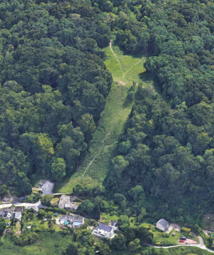
https://www.google.com/maps/@40.1349945,24.2962532,3a,75y,40h,90t/data=!3m8!1e1!3m6!1sAF1QipOVJ64_vHrcEDX9VmXHBZP1Fgc5Rf1rGOAxfwfJ!2e10!3e11!6shttps:%2F%2Flh5.googleusercontent.com%2Fp%2FAF1QipOVJ64_vHrcEDX9VmXHBZP1Fgc5Rf1rGOAxfwfJ%3Dw203-h100-k-no-pi-0-ya196.09602-ro-0-fo100!7i9728!8i4864

The highest point of elevation in Greece is one of the peaks of Mount Olympus. This was the fabled home of the Greek Pantheon. The first two images are from Google Earth.


https://www.google.com/maps/@38.2464072,21.7352981,3a,75y,100.82h,90t/data=!3m7!1e1!3m5!1s7Ex7lFVgqWBvgXVBA_wVLw!2e0!6s%2F%2Fgeo1.ggpht.com%2Fcbk%3Fpanoid%3D7Ex7lFVgqWBvgXVBA_wVLw%26output%3Dthumbnail%26cb_client%3Dmaps_sv.tactile.gps%26thumb%3D2%26w%3D203%26h%3D100%26yaw%3D103.677376%26pitch%3D0%26thumbfov%3D100!7i13312!8i6656

This is more of Patras.

https://www.google.com/maps/@38.2310258,21.7326977,3a,75y,74.36h,90t/data=!3m7!1e1!3m5!1sKET0O57b5ugivHQ7v6Hfdw!2e0!6s%2F%2Fgeo2.ggpht.com%2Fcbk%3Fpanoid%3DKET0O57b5ugivHQ7v6Hfdw%26output%3Dthumbnail%26cb_client%3Dmaps_sv.tactile.gps%26thumb%3D2%26w%3D203%26h%3D100%26yaw%3D74.3645%26pitch%3D0%26thumbfov%3D100!7i13312!8i6656

On the island of Crete the Minoan civilization, named for the legendary king Minos, far pre-dated the Mycenean civilization on mainland Greece. The major city of Crete is now Heraklion, but nearby is the ruins of Knossos which was Europe's first city. The ruins of the famous Palace of Knossos have been discovered. These two images are from Google Street View.


The writing system of the Minoans, called Linear A, has never been deciphered, unlike the Linear B of the Myceneans on the mainland. The Greek alphabet, that is the predecessor of the Latin alphabet that we are using now, came much later.

Heraklion is a city of Arab origin, from the Ninth Century. Before becoming part of modern Greece, Crete was under Byzantine, Venetian and, Ottoman control. Crete was a theater of the endless battles between Venice and the Ottomans. The major Venetian fortress still stands at the harbor. The wall in the first of the following images, from Google Street View, is from the time of the Venetians. The second image, from Google Earth, is of Heraklion.


https://www.google.com/maps/@35.5167976,24.0209501,3a,75y,127.37h,90t/data=!3m7!1e1!3m5!1sSMfpcoDqGGxUq5K_WyPZyA!2e0!6s%2F%2Fgeo0.ggpht.com%2Fcbk%3Fpanoid%3DSMfpcoDqGGxUq5K_WyPZyA%26output%3Dthumbnail%26cb_client%3Dmaps_sv.tactile.gps%26thumb%3D2%26w%3D203%26h%3D100%26yaw%3D133.17487%26pitch%3D0%26thumbfov%3D100!7i13312!8i6656

Further east in the Mediterranean is the island of Cyprus. It is an independent country, and not part of Greece. Cyprus goes far back into ancient times and was once ruled by the Assyrians. Greeks settled there in early times and there was a movement for political union with Greece, called Enosis.

But Cyprus was later controlled by the Ottomans and people from what is now Turkey settled there. Like Crete, Cyprus was a theater of conflict between Venice and the Ottomans. The walls built by the Venetians are still a prominent part of the cityscape. A coup attempting to unite with Greece led Turkey to invade the island in 1974, in a declared effort to safeguard the Turkish Cypriot community.

The result was a division of the island into Greek and Turkish sectors. A new nation was declared, called Northern Cyprus, but no nation except Turkey recognizes it. Nicosia was made the capital city of Cyprus by the Byzantines, and is today divided into north and south much as Berlin was once divided into east and west.

This is a national flag. The reason that you do not see it very often is because Turkey is the only country to have given diplomatic recognition to Northern Cyprus as a nation.

https://en.wikipedia.org/wiki/Northern_Cyprus#/media/File:Flag_of_the_Turkish_Republic_of_Northern_Cyprus.svg

Here is a look at the Greek Cypriot side of Nicosia. The first image is from Google Street View.