Cape Town is the spectacularly attractive port city on the Atlantic coast of South Africa. This city was the beginning of modern South Africa, interior cities like Johannesburg and Pretoria came much later. We could say that Cape Town is the first-generation city, while Johannesburg and Pretoria are second-generation. In the days of travel by ship, Cape Town is where migrants on their way to the interior landed.
Cape Town began as a way station for European ships going around southern Africa, on their way to Asia. It was built around a natural harbor and was the ideal place to stop and resupply. One Portuguese ship that got knocked off this route by a storm ended up crossing the Atlantic Ocean, and landing on the coast of what is now Brazil.Those who lived at Cape Town were Dutch. Their language, changing with the African influences, became known as the dialect of "Cape Dutch", and then grew into the separate language of Afrikaans. There is still quite a bit of mutual intelligibility between the two languages, meaning that someone speaking Dutch and someone speaking Afrikaans can understand much of what the other says. The Dutch influence can be clearly seen in the architecture of some of the older buildings, with the "bell-shaped" facade. Image from Google Street View.

In a situation that would be familiar to anyone from Quebec, the northern suburbs of Cape Town tend to speak Afrikaans, while the southern suburbs speak mostly English.
One of the first things that comes to mind about South Africa is it's medical genius. Cape Town was where Dr. Christiaan Barnard was from, who performed the world's first successful heart transplant.
The following scenes begin within the Castle of Good Hope. This was a Dutch fortress where it could be said that Cape Town began. It is not a coincidence that the Castle of Good Hope bears some resemblance to the Peter and Paul Fortress that we saw in the posting on this blog, "St. Petersburg And The Romanovs". That is because Peter the Great spent time living in the Netherlands before building St. Petersburg.


There are multiple scenes following. To see the scenes, after the first one, you must first click the up arrow, ^, before you can move on to the next scene by clicking the right or forward arrow, >. After clicking the up arrow, you can then hide the previews of successive scenes, if you wish.
https://www.google.com/maps/@-33.9256935,18.4274347,3a,75y,45.93h,90t/data=!3m7!1e1!3m5!1sv6SRoqQw-OgE5WWWkEufZw!2e0!6s%2F%2Fgeo2.ggpht.com%2Fcbk%3Fpanoid%3Dv6SRoqQw-OgE5WWWkEufZw%26output%3Dthumbnail%26cb_client%3Dmaps_sv.tactile.gps%26thumb%3D2%26w%3D203%26h%3D100%26yaw%3D40.600384%26pitch%3D0%26thumbfov%3D100!7i13312!8i6656
These two images, from Google Earth, are of the downtown area of Cape Town.


https://www.google.com/maps/@-33.9168366,18.4132362,3a,75y,111.15h,90t/data=!3m7!1e1!3m5!1syrDPpnZFe4LEbwiS7FK1KQ!2e0!6s%2F%2Fgeo0.ggpht.com%2Fcbk%3Fpanoid%3DyrDPpnZFe4LEbwiS7FK1KQ%26output%3Dthumbnail%26cb_client%3Dmaps_sv.tactile.gps%26thumb%3D2%26w%3D203%26h%3D100%26yaw%3D114.99312%26pitch%3D0%26thumbfov%3D100!7i13312!8i6656
This is around the Victoria and Albert Waterfront and the port of Cape Town. The hill that Cape Town is built all around is Signal Hill. The first image is from Google Earth.

https://www.google.com/maps/@-33.9030229,18.4213827,3a,75y,42.29h,90t/data=!3m8!1e1!3m6!1sAF1QipMftx_qmBe9nFVlFLLgceAOdDL-NDYEsbM0g9FP!2e10!3e11!6shttps:%2F%2Flh5.googleusercontent.com%2Fp%2FAF1QipMftx_qmBe9nFVlFLLgceAOdDL-NDYEsbM0g9FP%3Dw203-h100-k-no-pi-0-ya261.68103-ro0-fo100!7i12692!8i6346
These scenes are of the residential area of Kensington. The first image is from Google Earth.

https://www.google.com/maps/@-33.9115716,18.5077706,3a,75y,104.34h,90t/data=!3m7!1e1!3m5!1sli65xsLzrLNo3Z9iC1UpSA!2e0!6s%2F%2Fgeo1.ggpht.com%2Fcbk%3Fpanoid%3Dli65xsLzrLNo3Z9iC1UpSA%26output%3Dthumbnail%26cb_client%3Dmaps_sv.tactile.gps%26thumb%3D2%26w%3D203%26h%3D100%26yaw%3D107.11805%26pitch%3D0%26thumbfov%3D100!7i13312!8i6656
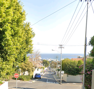
Between the ocean and Signal Hill, this is Fresnaye. The first two scenes are from Google Street View.

https://www.google.com/maps/@-33.9238548,18.3878621,3a,75y,14.42h,90t/data=!3m7!1e1!3m5!1s2CQ4kTdWqOoA-i8lRzAY6A!2e0!6s%2F%2Fgeo0.ggpht.com%2Fcbk%3Fpanoid%3D2CQ4kTdWqOoA-i8lRzAY6A%26output%3Dthumbnail%26cb_client%3Dmaps_sv.tactile.gps%26thumb%3D2%26w%3D203%26h%3D100%26yaw%3D12.042924%26pitch%3D0%26thumbfov%3D100!7i13312!8i6656
Just off the coast of Cape Town is Robben Island, where Nelson Mandela was imprisoned for nearly two decades. In fact, several presidents of South Africa had previously been imprisoned there. it looks like the South African version of Alcatraz.
https://www.google.com/maps/@-33.8003858,18.3724032,2a,75y,193.23h,90t/data=!3m7!1e1!3m5!1sdgpArLhKHWgAAAQpnTaFfQ!2e0!6s%2F%2Fgeo1.ggpht.com%2Fcbk%3Fpanoid%3DdgpArLhKHWgAAAQpnTaFfQ%26output%3Dthumbnail%26cb_client%3Dmaps_sv.tactile.gps%26thumb%3D2%26w%3D203%26h%3D100%26yaw%3D191.0561%26pitch%3D0%26thumbfov%3D100!7i13312!8i6656
Well to the south of the city, on the shore of False Bay, is the area known as The Strand, which is known for it's beach. The first two scenes are from Google Street View.


One of the first things that comes to mind about South Africa is it's medical genius. Cape Town was where Dr. Christiaan Barnard was from, who performed the world's first successful heart transplant.
The following scenes begin within the Castle of Good Hope. This was a Dutch fortress where it could be said that Cape Town began. It is not a coincidence that the Castle of Good Hope bears some resemblance to the Peter and Paul Fortress that we saw in the posting on this blog, "St. Petersburg And The Romanovs". That is because Peter the Great spent time living in the Netherlands before building St. Petersburg.
The first three images are from Google Street View.


There are multiple scenes following. To see the scenes, after the first one, you must first click the up arrow, ^, before you can move on to the next scene by clicking the right or forward arrow, >. After clicking the up arrow, you can then hide the previews of successive scenes, if you wish.
https://www.google.com/maps/@-33.9256935,18.4274347,3a,75y,45.93h,90t/data=!3m7!1e1!3m5!1sv6SRoqQw-OgE5WWWkEufZw!2e0!6s%2F%2Fgeo2.ggpht.com%2Fcbk%3Fpanoid%3Dv6SRoqQw-OgE5WWWkEufZw%26output%3Dthumbnail%26cb_client%3Dmaps_sv.tactile.gps%26thumb%3D2%26w%3D203%26h%3D100%26yaw%3D40.600384%26pitch%3D0%26thumbfov%3D100!7i13312!8i6656
These two images, from Google Earth, are of the downtown area of Cape Town.


From the Castle of Good Hope, the scenes here are gradually moving further away from the center of the city. Here is the area of Strand Street, in downtown Cape Town. The mountain with the flat top is Table Mountain. Remember that the geological configuration of Cape Town is part of the geology theory as described in "The Story Of Planet Earth", on the geology blog, particularly the Supporting Document 72) "The Mystery Of Table Mountain And Cape Town".
https://www.google.com/maps/@-33.9203805,18.4210886,3a,75y,260.34h,90t/data=!3m7!1e1!3m5!1sQd8nEeLktQ5z9zI8p0knjA!2e0!6s%2F%2Fgeo3.ggpht.com%2Fcbk%3Fpanoid%3DQd8nEeLktQ5z9zI8p0knjA%26output%3Dthumbnail%26cb_client%3Dmaps_sv.tactile.gps%26thumb%3D2%26w%3D203%26h%3D100%26yaw%3D258.40695%26pitch%3D0%26thumbfov%3D100!7i13312!8i6656
This is the Bo-Kaap area, between downtown and Signal Hill, which is known for how colorful some of it's buildings are. The first two scenes are from Google Street View.


https://www.google.com/maps/@-33.9168366,18.4132362,3a,75y,111.15h,90t/data=!3m7!1e1!3m5!1syrDPpnZFe4LEbwiS7FK1KQ!2e0!6s%2F%2Fgeo0.ggpht.com%2Fcbk%3Fpanoid%3DyrDPpnZFe4LEbwiS7FK1KQ%26output%3Dthumbnail%26cb_client%3Dmaps_sv.tactile.gps%26thumb%3D2%26w%3D203%26h%3D100%26yaw%3D114.99312%26pitch%3D0%26thumbfov%3D100!7i13312!8i6656
This is around the Victoria and Albert Waterfront and the port of Cape Town. The hill that Cape Town is built all around is Signal Hill. The first image is from Google Earth.

https://www.google.com/maps/@-33.9030229,18.4213827,3a,75y,42.29h,90t/data=!3m8!1e1!3m6!1sAF1QipMftx_qmBe9nFVlFLLgceAOdDL-NDYEsbM0g9FP!2e10!3e11!6shttps:%2F%2Flh5.googleusercontent.com%2Fp%2FAF1QipMftx_qmBe9nFVlFLLgceAOdDL-NDYEsbM0g9FP%3Dw203-h100-k-no-pi-0-ya261.68103-ro0-fo100!7i12692!8i6346
These scenes are of the residential area of Kensington. The first image is from Google Earth.

https://www.google.com/maps/@-33.9115716,18.5077706,3a,75y,104.34h,90t/data=!3m7!1e1!3m5!1sli65xsLzrLNo3Z9iC1UpSA!2e0!6s%2F%2Fgeo1.ggpht.com%2Fcbk%3Fpanoid%3Dli65xsLzrLNo3Z9iC1UpSA%26output%3Dthumbnail%26cb_client%3Dmaps_sv.tactile.gps%26thumb%3D2%26w%3D203%26h%3D100%26yaw%3D107.11805%26pitch%3D0%26thumbfov%3D100!7i13312!8i6656
Between the ocean and Signal Hill, this is Fresnaye. The first two scenes are from Google Street View.


https://www.google.com/maps/@-33.9238548,18.3878621,3a,75y,14.42h,90t/data=!3m7!1e1!3m5!1s2CQ4kTdWqOoA-i8lRzAY6A!2e0!6s%2F%2Fgeo0.ggpht.com%2Fcbk%3Fpanoid%3D2CQ4kTdWqOoA-i8lRzAY6A%26output%3Dthumbnail%26cb_client%3Dmaps_sv.tactile.gps%26thumb%3D2%26w%3D203%26h%3D100%26yaw%3D12.042924%26pitch%3D0%26thumbfov%3D100!7i13312!8i6656
Just off the coast of Cape Town is Robben Island, where Nelson Mandela was imprisoned for nearly two decades. In fact, several presidents of South Africa had previously been imprisoned there. it looks like the South African version of Alcatraz.
https://www.google.com/maps/@-33.8003858,18.3724032,2a,75y,193.23h,90t/data=!3m7!1e1!3m5!1sdgpArLhKHWgAAAQpnTaFfQ!2e0!6s%2F%2Fgeo1.ggpht.com%2Fcbk%3Fpanoid%3DdgpArLhKHWgAAAQpnTaFfQ%26output%3Dthumbnail%26cb_client%3Dmaps_sv.tactile.gps%26thumb%3D2%26w%3D203%26h%3D100%26yaw%3D191.0561%26pitch%3D0%26thumbfov%3D100!7i13312!8i6656
Well to the south of the city, on the shore of False Bay, is the area known as The Strand, which is known for it's beach. The first two scenes are from Google Street View.


No comments:
Post a Comment